
Magnitude |
:3 |
| Date & Time (UTC) | 2014-07-11 03:15:22.0 |
| Date & Time (Local) | 1393/4/20 07:45:22.0 |
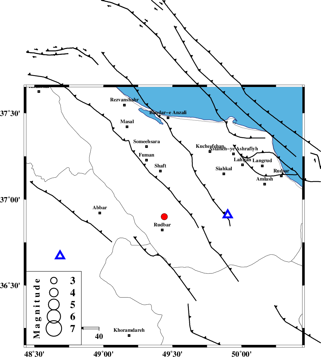
| Location | Lat:36.9 Lon: 49.44 |
| Region | Gilan Province, 9 km Rudbar |
Nearest Cities |
|
| 6 km North of Rostamabad, Gilan Province | |
| 9 km North of Rudbar, Gilan Province | |
| 10 km of Nasir mahalleh, Gilan Province | |
| 18 km North of Manjil, Gilan Province | |
| 21 km North West of Dashtvil, Gilan Province | |
| Depth | 14 km |
| Agency | |
Faults within 150 km: |
|
| LAHIJAN_F (Length: 92 km) , Distance to epicenter: 4 km | |
| RUDBAR_F (Length: 93 km) , Distance to epicenter: 10 km | |
| TALESH_F (Length: 258 km) , Distance to epicenter: 38 km | |
| Number of Phases | 5 |
| RMS | 0.3 |
| Number of Stations | 4 |
| Error in Latitude | >4 km |
| Error in Longitude | 5.3 km |
| Error in Depth | 8.7 km |
Download waveform in seisan format
to download seisan software Click here
to access information about IIEES stations Click here
Amplitude | ||||||||
| UID | Agency | Station | Component | Amplitude | Period | Arrival Time | Proccessing Time | Signal Clip |
| 92778 | IIEES | GRMI | E | 85.1 | 0.52 | 2014-07-11 03:16:35 | 2014-07-11 04:37:00 | n |
Phase | ||||||||||||
| Agency | Station | Component | Phase Type | Phase Quality | First Motion | Observed Arrival Time | Time Residual | Loc. Flag | Input Weight | Distance | Azimuth | |
| IIEES | ZNJK | Z | Pg | E | 2014-07-11 03:15:34 | -0.33 | y | 72.3 | 250 | |||
| IIEES | CHTH | Z | Pg | E | 2014-07-11 03:15:52 | -0.35 | y | 187 | 126 | |||
| IIEES | GRMI | Z | Pn | E | 2014-07-11 03:16:01 | 0.33 | y | 252 | 328 | |||
| IIEES | ASAO | Z | Pn | E | 2014-07-11 03:16:03 | 0.07 | y | 266 | 168 | |||
| IIEES | ASAO | E | Sg | E | 2014-07-11 03:16:37 | 0.3 | y | 266 | 168 | |||