
Magnitude |
:3.3 |
| Date & Time (UTC) | 2014-07-09 02:52:09.7 |
| Date & Time (Local) | 1393/4/18 07:22:09.7 |
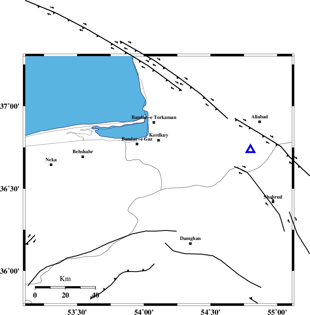
| Location | Lat:36.55 Lon: 54.11 |
| Region | Mazandaran Province, 27 km South of Kordkuy |
Nearest Cities |
|
| 21 km South of Sarkalateh, Golestan Province | |
| 21 km East of Sefid chah, Mazandaran Province | |
| 25 km South East of Nokandeh, Golestan Province | |
| 26 km East of Bishehboneh, Mazandaran Province | |
| 26 km South East of Gaz-e gharbi, Golestan Province | |
| Depth | 14 km |
| Agency | |
Faults within 150 km: |
|
| N_ALBORZ_F (Length: 360 km) , Distance to epicenter: 5 km | |
| ASTANEH_F (Length: 72 km) , Distance to epicenter: 19 km | |
| KHAZAR_F (Length: 523 km) , Distance to epicenter: 22 km | |
| Number of Phases | 6 |
| RMS | 0.1 |
| Number of Stations | 5 |
| Error in Latitude | >4.6 km |
| Error in Longitude | 4.1 km |
| Error in Depth | 11 km |
Download waveform in seisan format
to download seisan software Click here
to access information about IIEES stations Click here
Amplitude | ||||||||
| UID | Agency | Station | Component | Amplitude | Period | Arrival Time | Proccessing Time | Signal Clip |
| 92772 | IIEES | GHVR | E | 82.7 | 0.4 | 2014-07-09 02:53:49 | 2014-07-09 04:14:00 | n |
Phase | ||||||||||||
| Agency | Station | Component | Phase Type | Phase Quality | First Motion | Observed Arrival Time | Time Residual | Loc. Flag | Input Weight | Distance | Azimuth | |
| IIEES | CHTH | Z | Pn | E | 2014-07-09 02:52:52 | 0.14 | y | 277 | 256 | |||
| IIEES | GHVR | Z | Pn | E | 2014-07-09 02:53:00 | 0.1 | y | 346 | 229 | |||
| IIEES | GHVR | E | Sg | E | 2014-07-09 02:53:46 | -0.07 | y | 346 | 229 | |||
| IIEES | TABS | Z | Pn | E | 2014-07-09 02:53:09 | -0.1 | y | 423 | 139 | |||
| IIEES | YZKH | Z | Pn | E | 2014-07-09 02:53:15 | 0.05 | y | 463 | 174 | |||
| IIEES | GRMI | Z | Pn | E | 2014-07-09 02:53:32 | -0.21 | y | 603 | 297 | |||