
Magnitude |
:3.2 |
| Date & Time (UTC) | 2014-07-05 11:32:35.4 |
| Date & Time (Local) | 1393/4/14 16:02:35.4 |
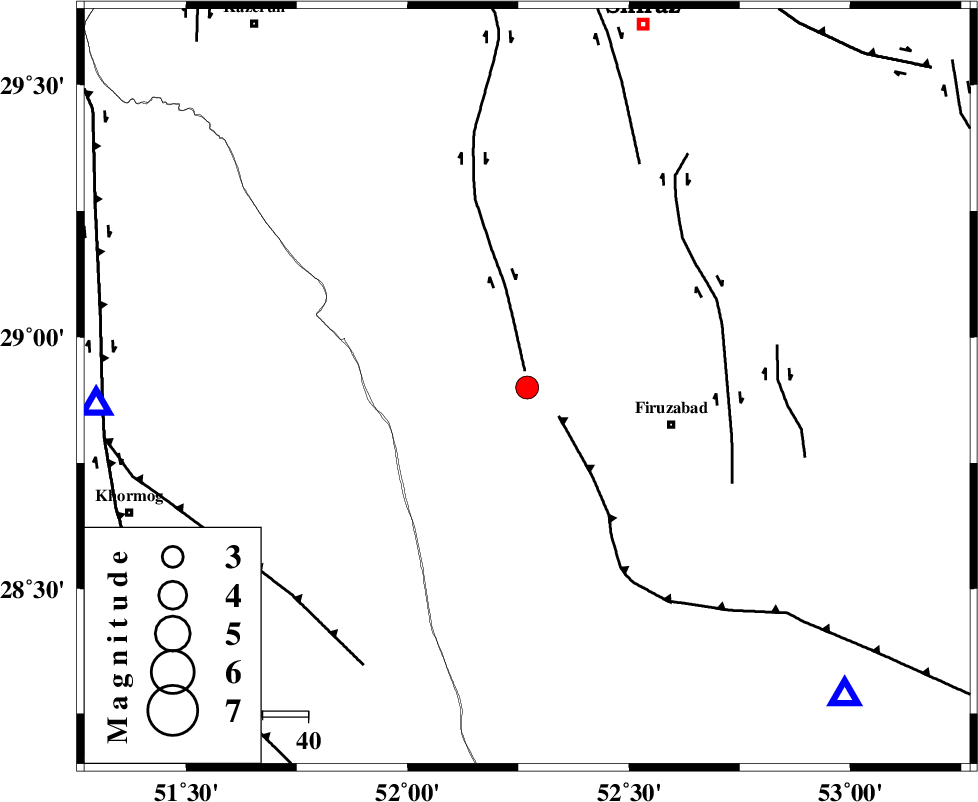
| Location | Lat:28.9 Lon: 52.27 |
| Region | Fars Province, 18 km East of Farashband |
Nearest Cities |
|
| 18 km North East of Farashband, Fars Province | |
| 21 km East of Aviz, Fars Province | |
| 24 km South of Dadanjan, Fars Province | |
| 26 km North West of Ahmadabad, Fars Province | |
| 33 km North West of Firuz Abad, Fars Province | |
| Depth | 15 km |
| Agency | |
Faults within 150 km: |
|
| KAREBASS_F (Length: 98 km) , Distance to epicenter: 4 km | |
| QIR_F (Length: 130 km) , Distance to epicenter: 9 km | |
| SABZ_PUSHAN_F_Z1 (Length: 69 km) , Distance to epicenter: 45 km | |
| Number of Phases | 4 |
| RMS | 0 |
| Number of Stations | 4 |
| Error in Latitude | >8.8 km |
| Error in Longitude | 2 km |
| Error in Depth | 0 km |
Download waveform in seisan format
to download seisan software Click here
to access information about IIEES stations Click here
Amplitude | ||||||||
| UID | Agency | Station | Component | Amplitude | Period | Arrival Time | Proccessing Time | Signal Clip |
| 92748 | IIEES | KRBR | N | 27.8 | 0.62 | 2014-07-05 11:34:52 | 2014-07-06 05:34:00 | n |
Phase | ||||||||||||
| Agency | Station | Component | Phase Type | Phase Quality | First Motion | Observed Arrival Time | Time Residual | Loc. Flag | Input Weight | Distance | Azimuth | |
| IIEES | YZKH | Z | Pn | E | 2014-07-05 11:33:38 | 0.04 | y | 446 | 29 | |||
| IIEES | KRBR | Z | Pn | E | 2014-07-05 11:33:39 | 0.01 | y | 452 | 74 | |||
| IIEES | ASAO | Z | Pn | E | 2014-07-05 11:34:05 | -0.01 | y | 661 | 342 | |||
| IIEES | TABS | Z | Pn | E | 2014-07-05 11:34:10 | -0.07 | y | 700 | 40 | |||