
Magnitude |
:2.3 |
| Date & Time (UTC) | 2014-07-04 16:11:50.6 |
| Date & Time (Local) | 1393/4/13 20:41:50.6 |
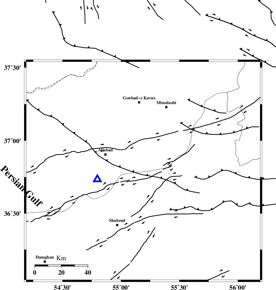
| Location | Lat:36.79 Lon: 55.19 |
| Region | Golestan Province, 25 km South of Ramian |
Nearest Cities |
|
| 17 km North West of Kalateh khanj, Semnan Province | |
| 19 km North of Qaleh-ye nokharqan, Semnan Province | |
| 25 km South of Ramian, Golestan Province | |
| 27 km South West of Farsian, Golestan Province | |
| 30 km South East of Deland, Golestan Province | |
| Depth | 18 km |
| Agency | |
Faults within 150 km: |
|
| SHAVAR_F (Length: 87 km) , Distance to epicenter: 3 km | |
| ROBATE_QARABIL_F (Length: 168 km) , Distance to epicenter: 24 km | |
| KHAZAR_F (Length: 523 km) , Distance to epicenter: 31 km | |
| Number of Phases | 6 |
| RMS | 0 |
| Number of Stations | 4 |
| Error in Latitude | >1.3 km |
| Error in Longitude | 1.8 km |
| Error in Depth | 2.4 km |
Download waveform in seisan format
to download seisan software Click here
to access information about IIEES stations Click here
Amplitude | ||||||||
| UID | Agency | Station | Component | Amplitude | Period | Arrival Time | Proccessing Time | Signal Clip |
| 92734 | IIEES | CHTH | E | 6.9 | 0.28 | 2014-07-04 16:13:42 | 2014-07-04 05:59:00 | n |
| 92735 | IIEES | TABS | N | 6.6 | 0.64 | 2014-07-04 16:13:32 | 2014-07-04 05:59:00 | n |
Phase | ||||||||||||
| Agency | Station | Component | Phase Type | Phase Quality | First Motion | Observed Arrival Time | Time Residual | Loc. Flag | Input Weight | Distance | Azimuth | |
| IIEES | SHRO | Z | Pg | E | 2014-07-04 16:12:09 | -0.02 | y | 115 | 139 | |||
| IIEES | BJRD | Z | Pn | E | 2014-07-04 16:12:25 | -0.05 | y | 221 | 62 | |||
| IIEES | BJRD | E | Sg | E | 2014-07-04 16:12:53 | 0.04 | y | 221 | 62 | |||
| IIEES | CHTH | Z | Pn | E | 2014-07-04 16:12:45 | 0.03 | y | 377 | 256 | |||
| IIEES | TABS | Z | Pn | E | 2014-07-04 16:12:46 | -0.02 | y | 391 | 153 | |||
| IIEES | TABS | N | S | E | 2014-07-04 16:13:27 | 0.03 | y | 391 | 153 | |||