
Magnitude |
:3.3 |
| Date & Time (UTC) | 2014-07-03 14:12:11.5 |
| Date & Time (Local) | 1393/4/12 18:42:11.5 |
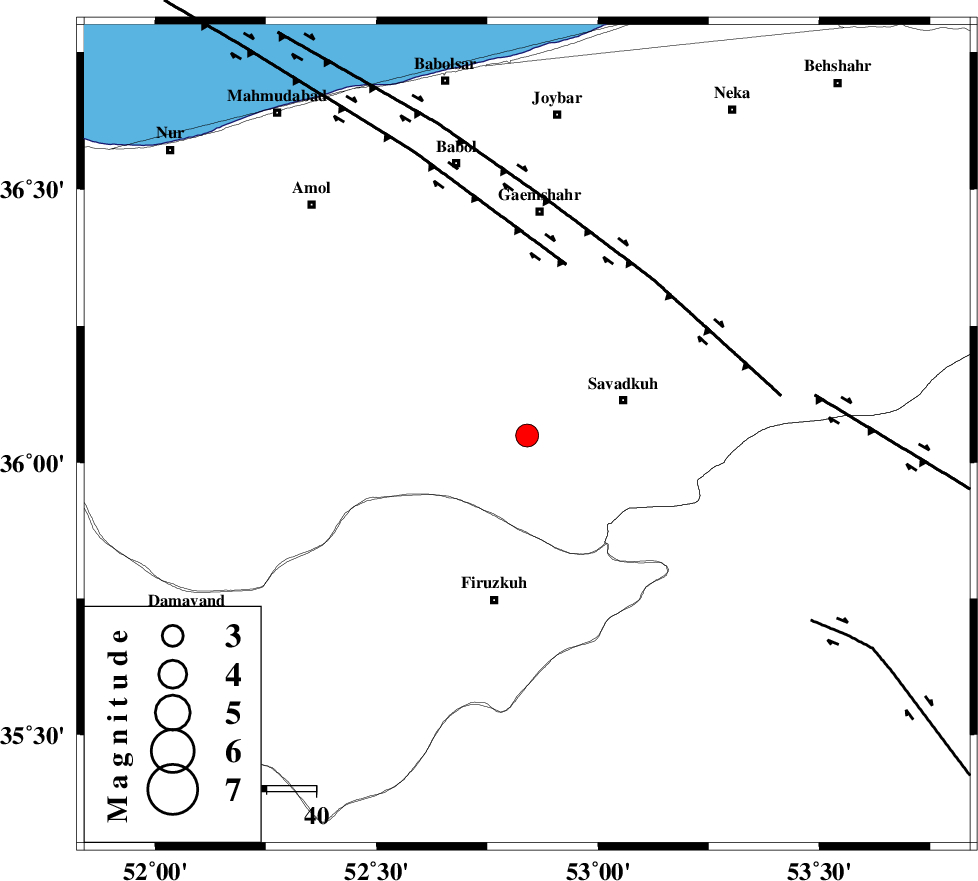
| Location | Lat:36.05 Lon: 52.84 |
| Region | Mazandaran Province, 21 km West of Pol-E-Sefid |
Nearest Cities |
|
| 2 km of Alasht, Mazandaran Province | |
| 13 km West of Elahband, Mazandaran Province | |
| 18 km South West of Zirab, Mazandaran Province | |
| 20 km West of Shurmast-e peyrudbar, Mazandaran Province | |
| 21 km West of Pol-E-Sefid, Mazandaran Province | |
| Depth | 14 km |
| Agency | |
Faults within 150 km: |
|
| N_ALBORZ_F (Length: 360 km) , Distance to epicenter: 15 km | |
| KHAZAR_F (Length: 523 km) , Distance to epicenter: 38 km | |
| ATARI_F (Length: 185 km) , Distance to epicenter: 40 km | |
| Number of Phases | 5 |
| RMS | 0.2 |
| Number of Stations | 4 |
| Error in Latitude | >3.8 km |
| Error in Longitude | 4.1 km |
| Error in Depth | 6.5 km |
Download waveform in seisan format
to download seisan software Click here
to access information about IIEES stations Click here
Amplitude | ||||||||
| UID | Agency | Station | Component | Amplitude | Period | Arrival Time | Proccessing Time | Signal Clip |
| 92731 | IIEES | GHVR | E | 231.4 | 0.44 | 2014-07-03 14:13:22 | 2014-07-03 03:37:00 | n |
Phase | ||||||||||||
| Agency | Station | Component | Phase Type | Phase Quality | First Motion | Observed Arrival Time | Time Residual | Loc. Flag | Input Weight | Distance | Azimuth | |
| IIEES | CHTH | Z | Pg | E | 2014-07-03 14:12:37 | -0.12 | y | 155 | 265 | |||
| IIEES | GHVR | Z | Pn | E | 2014-07-03 14:12:47 | -0.07 | y | 227 | 220 | |||
| IIEES | GHVR | E | Sg | E | 2014-07-03 14:13:15 | -0.05 | y | 227 | 220 | |||
| IIEES | SHRO | Z | Pn | E | 2014-07-03 14:12:54 | -0.08 | y | 286 | 90 | |||
| IIEES | ASAO | Z | Pn | E | 2014-07-03 14:12:57 | 0.35 | y | 306 | 238 | |||