
Magnitude |
:2.8 |
| Date & Time (UTC) | 2014-07-02 13:01:26.1 |
| Date & Time (Local) | 1393/4/11 17:31:26.1 |
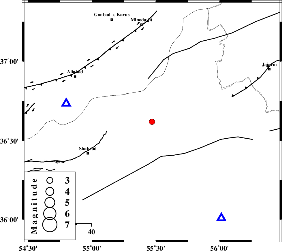
| Location | Lat:36.62 Lon: 55.47 |
| Region | Semnan Province, 68 km South of Minodasht |
Nearest Cities |
|
| 15 km East of Kalateh khanj, Semnan Province | |
| 29 km North West of Miamay, Semnan Province | |
| 33 km East of Qaleh-ye nokharqan, Semnan Province | |
| 37 km South of Farsian, Golestan Province | |
| 44 km South West of Qaleh qafeh, Semnan Province | |
| Depth | 10 km |
| Agency | |
Faults within 150 km: |
|
| MEYAMEY_F (Length: 141 km) , Distance to epicenter: 25 km | |
| SHAVAR_F (Length: 87 km) , Distance to epicenter: 29 km | |
| ROBATE_QARABIL_F (Length: 168 km) , Distance to epicenter: 30 km | |
| Number of Phases | 5 |
| RMS | 0 |
| Number of Stations | 3 |
| Error in Latitude | >2.1 km |
| Error in Longitude | 6.9 km |
| Error in Depth | 4.9 km |
Download waveform in seisan format
to download seisan software Click here
to access information about IIEES stations Click here
Amplitude | ||||||||
| UID | Agency | Station | Component | Amplitude | Period | Arrival Time | Proccessing Time | Signal Clip |
| 92721 | IIEES | BJRD | N | 81.1 | 0.08 | 2014-07-02 13:02:24 | 2014-07-02 03:58:00 | n |
Phase | ||||||||||||
| Agency | Station | Component | Phase Type | Phase Quality | First Motion | Observed Arrival Time | Time Residual | Loc. Flag | Input Weight | Distance | Azimuth | |
| IIEES | SHRO | Z | Pg | E | 2014-07-02 13:01:40 | -0.01 | y | 83.3 | 144 | |||
| IIEES | SHRO | E | Sg | E | 2014-07-02 13:01:51 | -0.04 | y | 83.3 | 144 | |||
| IIEES | BJRD | Z | Pn | E | 2014-07-02 13:02:00 | 0.02 | y | 210 | 55 | |||
| IIEES | TABS | Z | Pn | E | 2014-07-02 13:02:19 | -0.03 | y | 362 | 155 | |||
| IIEES | TABS | N | Sg | E | 2014-07-02 13:03:13 | 0.07 | y | 362 | 155 | |||