
Magnitude |
:3 |
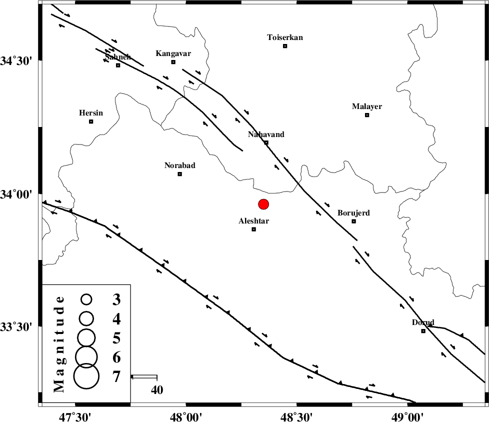
| Date & Time (UTC) | 2014-06-29 02:12:54.6 |
| Date & Time (Local) | 1393/4/8 06:42:54.6 |
| Location | Lat:33.96 Lon: 48.35 |
| Region | Lorestan Province, 12 km Aleshtar |
Nearest Cities |
|
| 11 km North of Aleshtar, Lorestan Province | |
| 12 km North of Dehrahim, Lorestan Province | |
| 17 km South West of Babaqasem, Hamedan Province | |
| 18 km North of Siyahpush, Lorestan Province | |
| 20 km North East of Firuz Abad, Lorestan Province | |
| Depth | 14 km |
| Agency | |
Faults within 150 km: |
|
| NAHAVAND_F (Length: 102 km) , Distance to epicenter: 18 km | |
| SAHANEH_F (Length: 77 km) , Distance to epicenter: 24 km | |
| DORUD (Length: 100 km) , Distance to epicenter: 41 km | |
| Number of Phases | 4 |
| RMS | 0.1 |
| Number of Stations | 3 |
| Error in Latitude | >6.1 km |
| Error in Longitude | 8.5 km |
| Error in Depth | 6.2 km |
Download waveform in seisan format
to download seisan software Click here
to access information about IIEES stations Click here
Amplitude | ||||||||
| UID | Agency | Station | Component | Amplitude | Period | Arrival Time | Proccessing Time | Signal Clip |
| 92694 | IIEES | ASAO | E | 199.8 | 0.6 | 2014-06-29 02:13:50 | 2014-06-29 03:34:00 | n |
| 92695 | IIEES | ASAO | N | 211.7 | 0.56 | 2014-06-29 02:13:53 | 2014-06-29 03:34:00 | n |
Phase | ||||||||||||
| Agency | Station | Component | Phase Type | Phase Quality | First Motion | Observed Arrival Time | Time Residual | Loc. Flag | Input Weight | Distance | Azimuth | |
| IIEES | KHMZ | Z | Pg | E | 2014-06-29 02:13:19 | -0.04 | y | 151 | 99 | |||
| IIEES | ASAO | Z | Pg | E | 2014-06-29 02:13:22 | -0.14 | y | 167 | 67 | |||
| IIEES | ASAO | N | Sg | E | 2014-06-29 02:13:42 | 0.04 | y | 167 | 67 | |||
| IIEES | GHVR | Z | Pn | E | 2014-06-29 02:13:36 | 0.15 | y | 273 | 77 | |||