
Magnitude |
:4 |
| Date & Time (UTC) | 2014-06-25 11:45:00.7 |
| Date & Time (Local) | 1393/4/4 16:15:00.7 |
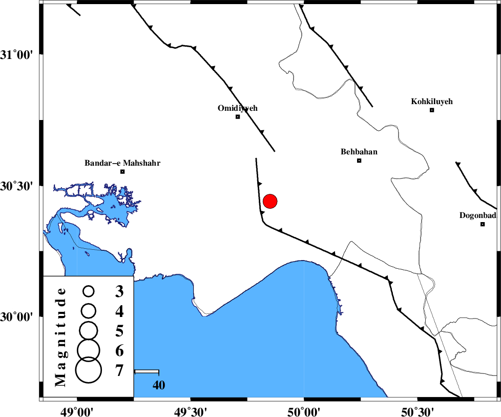
| Location | Lat:30.44 Lon: 49.85 |
| Region | Khoozestan Province, 26 km North-East of Hendijan |
Nearest Cities |
|
| 16 km East of Chamkhalf-e eisa, Khoozestan Province | |
| 18 km South of Asiyab, Khoozestan Province | |
| 22 km North West of Darunak, Khoozestan Province | |
| 26 km North East of Hendijan, Khoozestan Province | |
| 29 km South of Aghajari, Khoozestan Province | |
| Depth | 18 km |
| Agency | |
Faults within 150 km: |
|
| RAG_E_SEFID_F (Length: 84 km) , Distance to epicenter: 5 km | |
| AGHAJARI_F (Length: 88 km) , Distance to epicenter: 21 km | |
| MFF4 (Length: 62 km) , Distance to epicenter: 59 km | |
| Number of Phases | 8 |
| RMS | 0 |
| Number of Stations | 9 |
| Error in Latitude | >7.2 km |
| Error in Longitude | 3.5 km |
| Error in Depth | 7.5 km |
Download waveform in seisan format
to download seisan software Click here
to access information about IIEES stations Click here
Amplitude | ||||||||
| UID | Agency | Station | Component | Amplitude | Period | Arrival Time | Proccessing Time | Signal Clip |
| 92677 | IIEES | AHRM | Z | 1557.9 | 0.76 | 2014-06-25 11:46:13 | 2014-06-25 01:36:00 | n |
| 92678 | IIEES | KRBR | E | 28.9 | 0.68 | 2014-06-25 11:48:09 | 2014-06-25 01:36:00 | n |
Phase | ||||||||||||
| Agency | Station | Component | Phase Type | Phase Quality | First Motion | Observed Arrival Time | Time Residual | Loc. Flag | Input Weight | Distance | Azimuth | |
| IIEES | SHGR | Z | Pn | E | 2014-06-25 11:45:34 | 0 | y | 210 | 332 | |||
| IIEES | SHGR | E | Sg | E | 2014-06-25 11:46:00 | 0 | y | 210 | 332 | |||
| IIEES | KHMZ | Z | Pn | E | 2014-06-25 11:45:53 | 0 | y | 366 | 2 | |||
| IIEES | ASAO | Z | Pn | E | 2014-06-25 11:46:04 | -0.06 | y | 456 | 2 | |||
| IIEES | GHVR | Z | Pn | E | 2014-06-25 11:46:06 | 0.05 | y | 467 | 16 | |||
| IIEES | YZKH | Z | Pn | E | 2014-06-25 11:46:10 | -0.04 | y | 500 | 63 | |||
| IIEES | SNGE | Z | Pn | E | 2014-06-25 11:46:18 | 0.02 | y | 566 | 336 | |||
| IIEES | TABS | Z | Pn | E | 2014-06-25 11:46:44 | 0.07 | y | 773 | 61 | |||