
Magnitude |
:3 |
| Date & Time (UTC) | 2014-06-15 12:40:50.3 |
| Date & Time (Local) | 1393/3/25 17:10:50.3 |
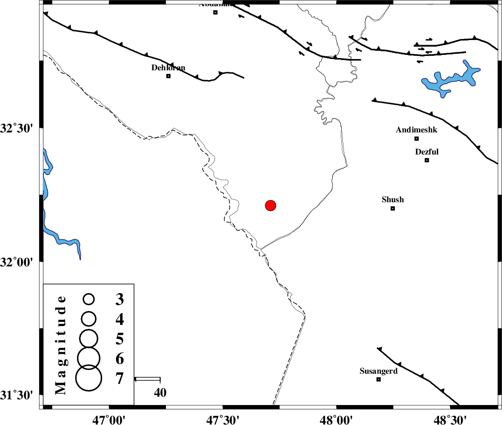
| Location | Lat:32.21 Lon: 47.71 |
| Region | Ilam Province, 51 km West of Shush |
Nearest Cities |
|
| 50 km South East of Musian, Ilam Province | |
| 51 km North West of Shush, Khoozestan Province | |
| 54 km North West of Amaleh teimur, Khoozestan Province | |
| 60 km North West of Bostan, Khoozestan Province | |
| 66 km South West of Andimeshk, Khoozestan Province | |
| Depth | 16 km |
| Agency | |
Faults within 150 km: |
|
| MFF6 (Length: 144 km) , Distance to epicenter: 54 km | |
| DEZFUL_EMBAYMENT (Length: 228 km) , Distance to epicenter: 60 km | |
| BALARUD_F_Z1 (Length: 87 km) , Distance to epicenter: 65 km | |
| Number of Phases | 5 |
| RMS | 0.1 |
| Number of Stations | 3 |
| Error in Latitude | >2 km |
| Error in Longitude | 5.1 km |
| Error in Depth | 5.6 km |
Download waveform in seisan format
to download seisan software Click here
to access information about IIEES stations Click here
Amplitude | ||||||||
| UID | Agency | Station | Component | Amplitude | Period | Arrival Time | Proccessing Time | Signal Clip |
| 92609 | IIEES | SHGR | E | 461.7 | 0.32 | 2014-06-15 12:41:30 | 2014-06-15 02:49:00 | n |
Phase | ||||||||||||
| Agency | Station | Component | Phase Type | Phase Quality | First Motion | Observed Arrival Time | Time Residual | Loc. Flag | Input Weight | Distance | Azimuth | |
| IIEES | SHGR | Z | Pg | E | 2014-06-15 12:41:07 | -0.01 | y | 104 | 96 | |||
| IIEES | SHGR | E | Sg | E | 2014-06-15 12:41:20 | 0.01 | y | 104 | 96 | |||
| IIEES | KHMZ | Z | Pn | E | 2014-06-15 12:41:31 | -0.09 | y | 271 | 51 | |||
| IIEES | ASAO | Z | Pn | E | 2014-06-15 12:41:40 | 0.1 | y | 337 | 39 | |||
| IIEES | ASAO | N | Sg | E | 2014-06-15 12:42:25 | -0.01 | y | 337 | 39 | |||