
Magnitude |
:2.6 |
| Date & Time (UTC) | 2014-06-15 02:21:26.3 |
| Date & Time (Local) | 1393/3/25 06:51:26.3 |
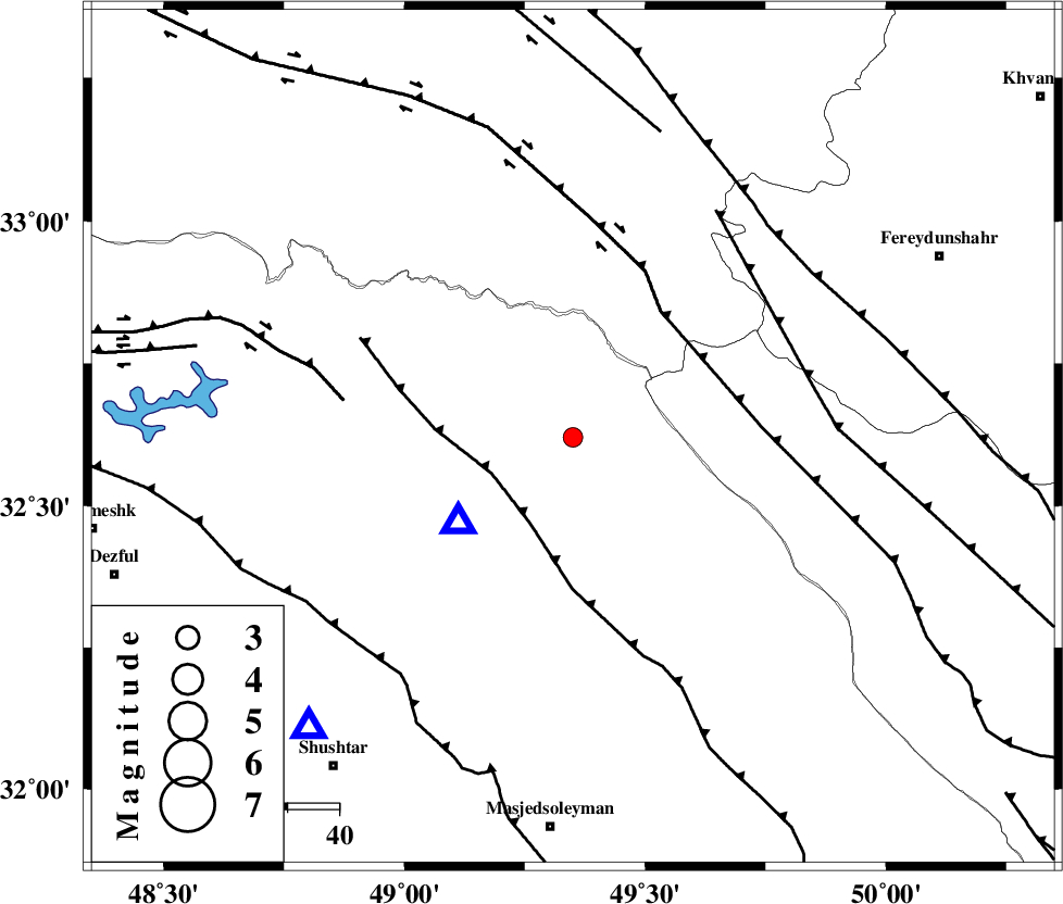
| Location | Lat:32.62 Lon: 49.35 |
| Region | Khoozestan Province, 34 km North-East of Lali |
Nearest Cities |
|
| 34 km South West of Parchal, Lorestan Province | |
| 34 km North East of Lali, Khoozestan Province | |
| 42 km North West of Paabshalal, Khoozestan Province | |
| 44 km North East of Jaefarabad, Khoozestan Province | |
| 47 km North of Qale-yekhvaju, Khoozestan Province | |
| Depth | 15 km |
| Agency | |
Faults within 150 km: |
|
| MFF2 (Length: 205 km) , Distance to epicenter: 17 km | |
| HZF4 (Length: 492 km) , Distance to epicenter: 30 km | |
| ZARDKUH_F (Length: 139 km) , Distance to epicenter: 30 km | |
| Number of Phases | 5 |
| RMS | 0.4 |
| Number of Stations | 4 |
| Error in Latitude | >17.2 km |
| Error in Longitude | 27.1 km |
| Error in Depth | 9.8 km |
Download waveform in seisan format
to download seisan software Click here
to access information about IIEES stations Click here
Amplitude | ||||||||
| UID | Agency | Station | Component | Amplitude | Period | Arrival Time | Proccessing Time | Signal Clip |
| 92608 | IIEES | SHGR | E | 264 | 0.4 | 2014-06-15 02:21:53 | 2014-06-15 03:41:00 | n |
Phase | ||||||||||||
| Agency | Station | Component | Phase Type | Phase Quality | First Motion | Observed Arrival Time | Time Residual | Loc. Flag | Input Weight | Distance | Azimuth | |
| IIEES | SHGR | Z | Pg | E | 2014-06-15 02:21:39 | -0.44 | y | 76.5 | 222 | |||
| IIEES | SHGR | E | Sg | E | 2014-06-15 02:21:49 | 0.26 | y | 76.5 | 222 | |||
| IIEES | KHMZ | Z | Pg | E | 2014-06-15 02:21:48 | -0.6 | y | 137 | 25 | |||
| IIEES | ASAO | Z | Pn | E | 2014-06-15 02:22:02 | 0.5 | y | 223 | 16 | |||
| IIEES | GHVR | Z | Pn | E | 2014-06-15 02:22:07 | 0.29 | y | 271 | 40 | |||