
Magnitude |
:3.5 |
| Date & Time (UTC) | 2014-06-12 19:55:42.2 |
| Date & Time (Local) | 1393/3/23 00:25:42.2 |
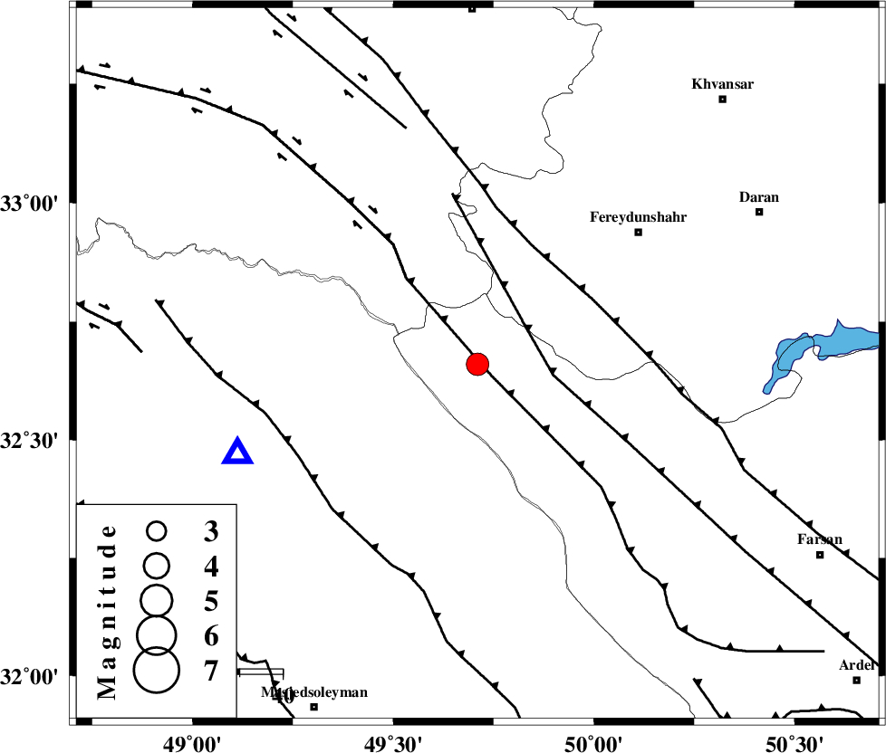
| Location | Lat:32.66 Lon: 49.71 |
| Region | Chaharmahal Bakhtiari Province, 45 km North-West of Chelgard |
Nearest Cities |
|
| 15 km West of Durak, Chaharmahal Bakhtiari Province | |
| 25 km South West of Masir, Esfahan Province | |
| 35 km South East of Parchal, Lorestan Province | |
| 41 km South West of Sibak, Esfahan Province | |
| 43 km North East of Paabshalal, Khoozestan Province | |
| Depth | 18 km |
| Agency | |
Faults within 150 km: |
|
| ZARDKUH_F (Length: 139 km) , Distance to epicenter: 4 km | |
| ARDAL_F (Length: 170 km) , Distance to epicenter: 14 km | |
| HZF4 (Length: 492 km) , Distance to epicenter: 26 km | |
| Number of Phases | 6 |
| RMS | 0.1 |
| Number of Stations | 4 |
| Error in Latitude | >2.7 km |
| Error in Longitude | 4.4 km |
| Error in Depth | 3.6 km |
Download waveform in seisan format
to download seisan software Click here
to access information about IIEES stations Click here
Amplitude | ||||||||
| UID | Agency | Station | Component | Amplitude | Period | Arrival Time | Proccessing Time | Signal Clip |
| 92586 | IIEES | SHGR | N | 1480.3 | 0.44 | 2014-06-12 19:56:20 | 2014-06-12 09:26:00 | n |
Phase | ||||||||||||
| Agency | Station | Component | Phase Type | Phase Quality | First Motion | Observed Arrival Time | Time Residual | Loc. Flag | Input Weight | Distance | Azimuth | |
| IIEES | SHGR | Z | Pg | E | 2014-06-12 19:56:00 | 0.11 | y | 105 | 234 | |||
| IIEES | ASAO | Z | Pn | E | 2014-06-12 19:56:15 | -0.04 | y | 211 | 8 | |||
| IIEES | ASAO | N | Sg | E | 2014-06-12 19:56:42 | -0.01 | y | 211 | 8 | |||
| IIEES | GHVR | Z | Pn | E | 2014-06-12 19:56:20 | -0.2 | y | 247 | 35 | |||
| IIEES | GHVR | N | Sg | E | 2014-06-12 19:56:52 | 0.2 | y | 247 | 35 | |||
| IIEES | CHTH | Z | Pn | E | 2014-06-12 19:56:37 | -0.06 | y | 383 | 20 | |||