
Magnitude |
:3.6 |
| Date & Time (UTC) | 2014-06-10 21:28:09.1 |
| Date & Time (Local) | 1393/3/21 01:58:09.1 |
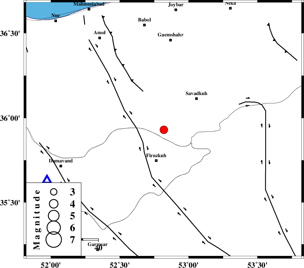
| Location | Lat:35.93 Lon: 52.82 |
| Region | Mazandaran Province, 21 km North of Firuzkuh |
Nearest Cities |
|
| 15 km South of Alasht, Mazandaran Province | |
| 19 km North East of Shahrabad, Tehran Province | |
| 21 km North of Firuzkuh, Tehran Province | |
| 23 km South West of Elahband, Mazandaran Province | |
| 27 km South West of Shurmast-e peyrudbar, Mazandaran Province | |
| Depth | 14 km |
| Agency | |
Faults within 150 km: |
|
| N_ALBORZ_F (Length: 360 km) , Distance to epicenter: 28 km | |
| ATARI_F (Length: 185 km) , Distance to epicenter: 29 km | |
| MOSHA_F (Length: 234 km) , Distance to epicenter: 31 km | |
| Number of Phases | 7 |
| RMS | 0.1 |
| Number of Stations | 7 |
| Error in Latitude | >2.8 km |
| Error in Longitude | 2.9 km |
| Error in Depth | 4.9 km |
Download waveform in seisan format
to download seisan software Click here
to access information about IIEES stations Click here
Amplitude | ||||||||
| UID | Agency | Station | Component | Amplitude | Period | Arrival Time | Proccessing Time | Signal Clip |
| 92571 | IIEES | THKV | E | 530.7 | 0.52 | 2014-06-10 21:28:56 | 2014-06-10 11:00:00 | n |
| 92572 | IIEES | THKV | N | 668.9 | 0.44 | 2014-06-10 21:28:59 | 2014-06-10 11:00:00 | n |
| 92573 | IIEES | GHVR | E | 613.8 | 0.72 | 2014-06-10 21:29:19 | 2014-06-10 11:00:00 | n |
| 92574 | IIEES | YZKH | E | 74.3 | 0.44 | 2014-06-10 21:30:19 | 2014-06-10 11:00:00 | n |
Phase | ||||||||||||
| Agency | Station | Component | Phase Type | Phase Quality | First Motion | Observed Arrival Time | Time Residual | Loc. Flag | Input Weight | Distance | Azimuth | |
| IIEES | CHTH | Z | Pg | E | 2014-06-10 21:28:34 | -0.16 | y | 153 | 270 | |||
| IIEES | GHVR | Z | Pn | E | 2014-06-10 21:28:43 | -0.08 | y | 215 | 222 | |||
| IIEES | GHVR | E | Sg | E | 2014-06-10 21:29:10 | -0.02 | y | 215 | 222 | |||
| IIEES | SHRO | Z | Pn | E | 2014-06-10 21:28:52 | 0.03 | y | 288 | 87 | |||
| IIEES | ASAO | Z | Pn | E | 2014-06-10 21:28:54 | 0.26 | y | 297 | 240 | |||
| IIEES | KHMZ | Z | Pn | E | 2014-06-10 21:29:01 | 0.1 | y | 356 | 228 | |||
| IIEES | YZKH | Z | Pn | E | 2014-06-10 21:29:09 | -0.13 | y | 425 | 157 | |||