
Magnitude |
:3.6 |
| Date & Time (UTC) | 2014-06-08 01:14:42.8 |
| Date & Time (Local) | 1393/3/18 05:44:42.8 |
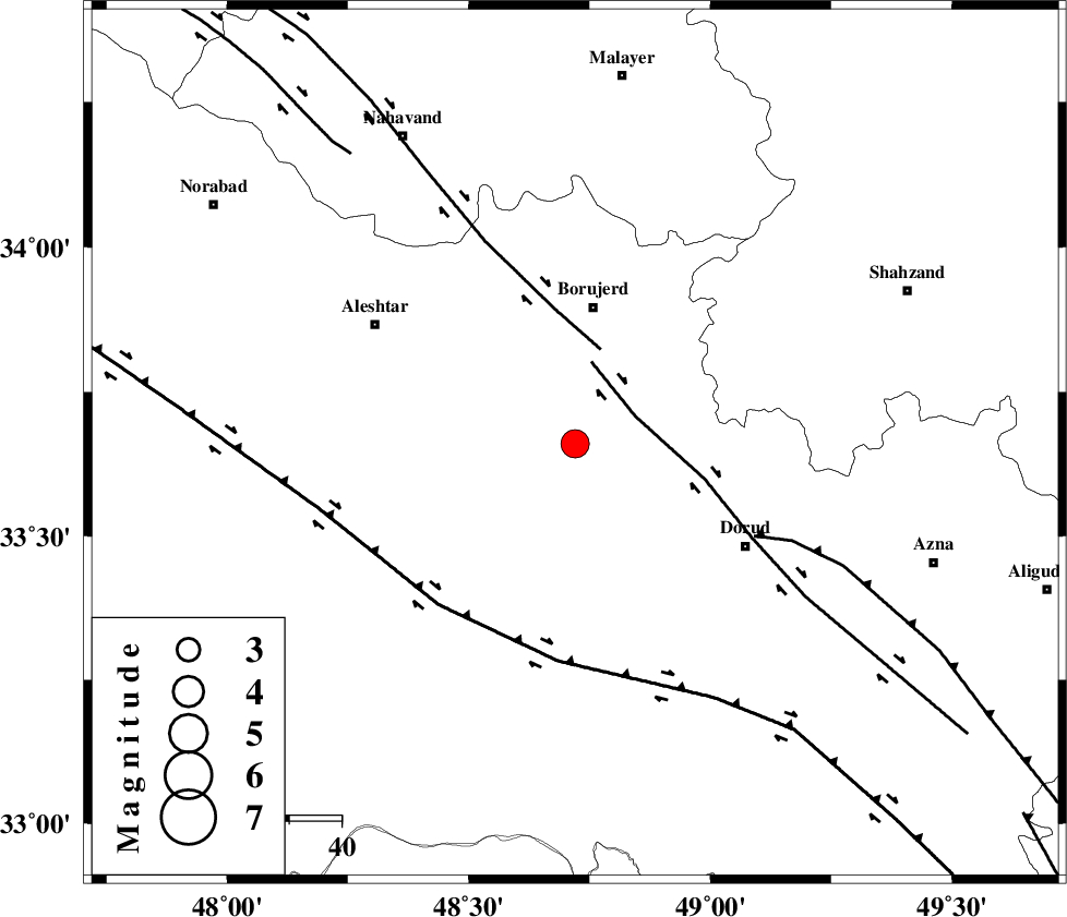
| Location | Lat:33.66 Lon: 48.72 |
| Region | Lorestan Province, 27 km South of Borujerd |
Nearest Cities |
|
| 13 km North East of Chogolvandi, Lorestan Province | |
| 14 km South of Pellekan-e sofla, Lorestan Province | |
| 15 km North East of Cheharborji, Lorestan Province | |
| 16 km West of Chalanchulan, Lorestan Province | |
| 17 km North of Zagheh, Lorestan Province | |
| Depth | 18 km |
| Agency | |
Faults within 150 km: |
|
| DORUD (Length: 100 km) , Distance to epicenter: 13 km | |
| NAHAVAND_F (Length: 102 km) , Distance to epicenter: 19 km | |
| MAIN_ZAGROS_R_F (Length: 1106 km) , Distance to epicenter: 39 km | |
| Number of Phases | 5 |
| RMS | 0.1 |
| Number of Stations | 4 |
| Error in Latitude | >3.2 km |
| Error in Longitude | 8.5 km |
| Error in Depth | 5.3 km |
Download waveform in seisan format
to download seisan software Click here
to access information about IIEES stations Click here
Amplitude | ||||||||
| UID | Agency | Station | Component | Amplitude | Period | Arrival Time | Proccessing Time | Signal Clip |
| 92563 | IIEES | SHGR | E | 744.6 | 0.56 | 2014-06-08 01:15:40 | 2014-06-08 02:44:00 | n |
Phase | ||||||||||||
| Agency | Station | Component | Phase Type | Phase Quality | First Motion | Observed Arrival Time | Time Residual | Loc. Flag | Input Weight | Distance | Azimuth | |
| IIEES | KHMZ | Z | Pg | E | 2014-06-08 01:15:02 | -0.13 | y | 116 | 85 | |||
| IIEES | ASAO | Z | Pg | E | 2014-06-08 01:15:08 | 0.16 | y | 156 | 50 | |||
| IIEES | SHGR | Z | Pg | E | 2014-06-08 01:15:11 | -0.18 | y | 172 | 177 | |||
| IIEES | SHGR | E | Sg | E | 2014-06-08 01:15:32 | 0.15 | y | 172 | 177 | |||
| IIEES | GHVR | Z | Pn | E | 2014-06-08 01:15:21 | 0 | y | 250 | 68 | |||