
Magnitude |
:2.3 |
| Date & Time (UTC) | 2014-05-25 14:59:23.5 |
| Date & Time (Local) | 1393/3/4 19:29:23.5 |
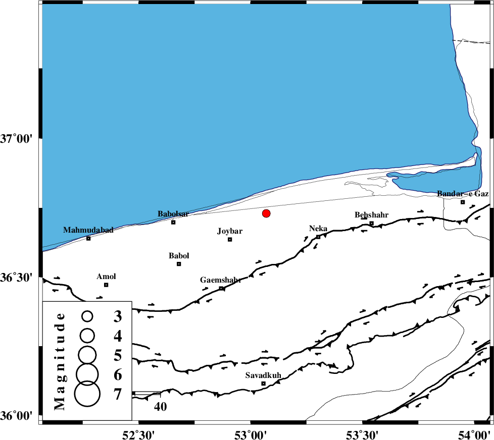
| Location | Lat:36.73 Lon: 53.07 |
| Region | Mazandaran Province, 19 km North of Sari |
Nearest Cities |
|
| 7 km of Farahabad, Mazandaran Province | |
| 12 km North East of Larim, Mazandaran Province | |
| 13 km North East of Kuhikhel, Mazandaran Province | |
| 16 km North West of Tuska, Mazandaran Province | |
| 17 km North East of Gelird, Mazandaran Province | |
| Depth | 41 km |
| Agency | |
Faults within 150 km: |
|
| KHAZAR_F (Length: 523 km) , Distance to epicenter: 22 km | |
| N_ALBORZ_F (Length: 360 km) , Distance to epicenter: 55 km | |
| DAMGHAN_F (Length: 95 km) , Distance to epicenter: 95 km | |
| Number of Phases | 6 |
| RMS | 0 |
| Number of Stations | 3 |
| Error in Latitude | >3.2 km |
| Error in Longitude | 3.9 km |
| Error in Depth | 3.7 km |
Download waveform in seisan format
to download seisan software Click here
to access information about IIEES stations Click here
Amplitude | ||||||||
| UID | Agency | Station | Component | Amplitude | Period | Arrival Time | Proccessing Time | Signal Clip |
| 92510 | IIEES | GHVR | E | 12.7 | 0.32 | 2014-05-25 15:00:51 | 2014-05-25 10:49:00 | n |
Phase | ||||||||||||
| Agency | Station | Component | Phase Type | Phase Quality | First Motion | Observed Arrival Time | Time Residual | Loc. Flag | Input Weight | Distance | Azimuth | |
| IIEES | DAMV | Z | Pg | E | 2014-05-25 14:59:49 | 0 | y | 157 | 220 | |||
| IIEES | DAMV | Z | Sg | E | 2014-05-25 15:00:08 | -0.01 | y | 157 | 220 | |||
| IIEES | CHTH | Z | Pn | E | 2014-05-25 14:59:53 | -0.05 | y | 197 | 243 | |||
| IIEES | CHTH | E | Sg | E | 2014-05-25 15:00:19 | 0.03 | y | 197 | 243 | |||
| IIEES | GHVR | Z | Pn | E | 2014-05-25 15:00:06 | 0.06 | y | 299 | 214 | |||
| IIEES | GHVR | E | Sg | E | 2014-05-25 15:00:45 | -0.02 | y | 299 | 214 | |||