
Magnitude |
:3.1 |
| Date & Time (UTC) | 2014-05-14 22:01:31.2 |
| Date & Time (Local) | 1393/2/25 02:31:31.2 |
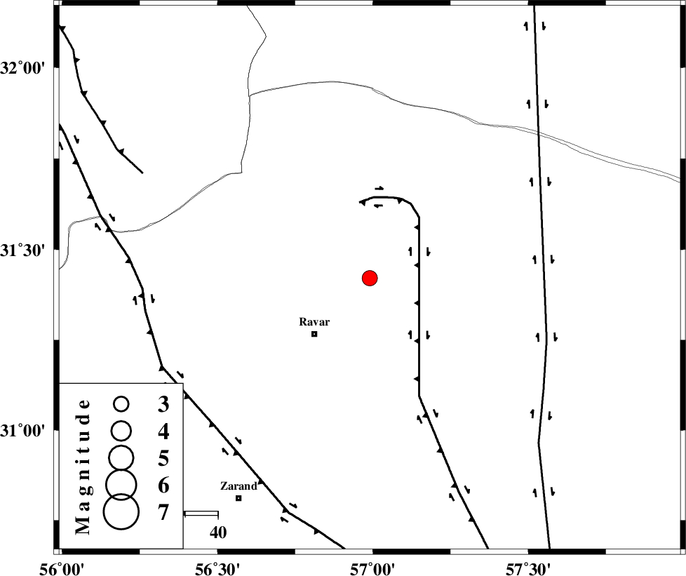
| Location | Lat:31.42 Lon: 56.99 |
| Region | Kerman Province, 24 km North-East of Ravar |
Nearest Cities |
|
| 21 km North East of Dehali, Kerman Province | |
| 24 km North East of Ravar, Kerman Province | |
| 57 km North East of Dasht-e khak, Kerman Province | |
| 57 km North East of Ahmadi, Kerman Province | |
| 62 km North East of Toghroljerd, Kerman Province | |
| Depth | 14 km |
| Agency | |
Faults within 150 km: |
|
| LAKARKUH_F (Length: 138 km) , Distance to epicenter: 23 km | |
| NAYBAND_F (Length: 258 km) , Distance to epicenter: 57 km | |
| KUHBANAN_F (Length: 189 km) , Distance to epicenter: 66 km | |
| Number of Phases | 6 |
| RMS | 0.1 |
| Number of Stations | 4 |
| Error in Latitude | >1.7 km |
| Error in Longitude | 1.1 km |
| Error in Depth | 3.3 km |
Download waveform in seisan format
to download seisan software Click here
to access information about IIEES stations Click here
Amplitude | ||||||||
| UID | Agency | Station | Component | Amplitude | Period | Arrival Time | Proccessing Time | Signal Clip |
| 92428 | IIEES | KRBR | N | 255.9 | 0.6 | 2014-05-14 22:02:22 | 2014-05-15 03:33:00 | n |
Phase | ||||||||||||
| Agency | Station | Component | Phase Type | Phase Quality | First Motion | Observed Arrival Time | Time Residual | Loc. Flag | Input Weight | Distance | Azimuth | |
| IIEES | KRBR | Z | Pg | E | 2014-05-14 22:01:58 | -0.05 | y | 161 | 188 | |||
| IIEES | BSRN | Z | Pn | E | 2014-05-14 22:02:05 | 0.17 | y | 211 | 73 | |||
| IIEES | BSRN | N | Sg | E | 2014-05-14 22:02:31 | -0.03 | y | 211 | 73 | |||
| IIEES | TABS | Z | Pn | E | 2014-05-14 22:02:09 | -0.16 | y | 247 | 3 | |||
| IIEES | YZKH | Z | Pn | E | 2014-05-14 22:02:10 | 0.04 | y | 251 | 296 | |||
| IIEES | YZKH | N | Sg | E | 2014-05-14 22:02:42 | 0.04 | y | 251 | 296 | |||