
Magnitude |
:3.1 |
| Date & Time (UTC) | 2014-05-03 16:24:43.1 |
| Date & Time (Local) | 1393/2/13 20:54:43.1 |
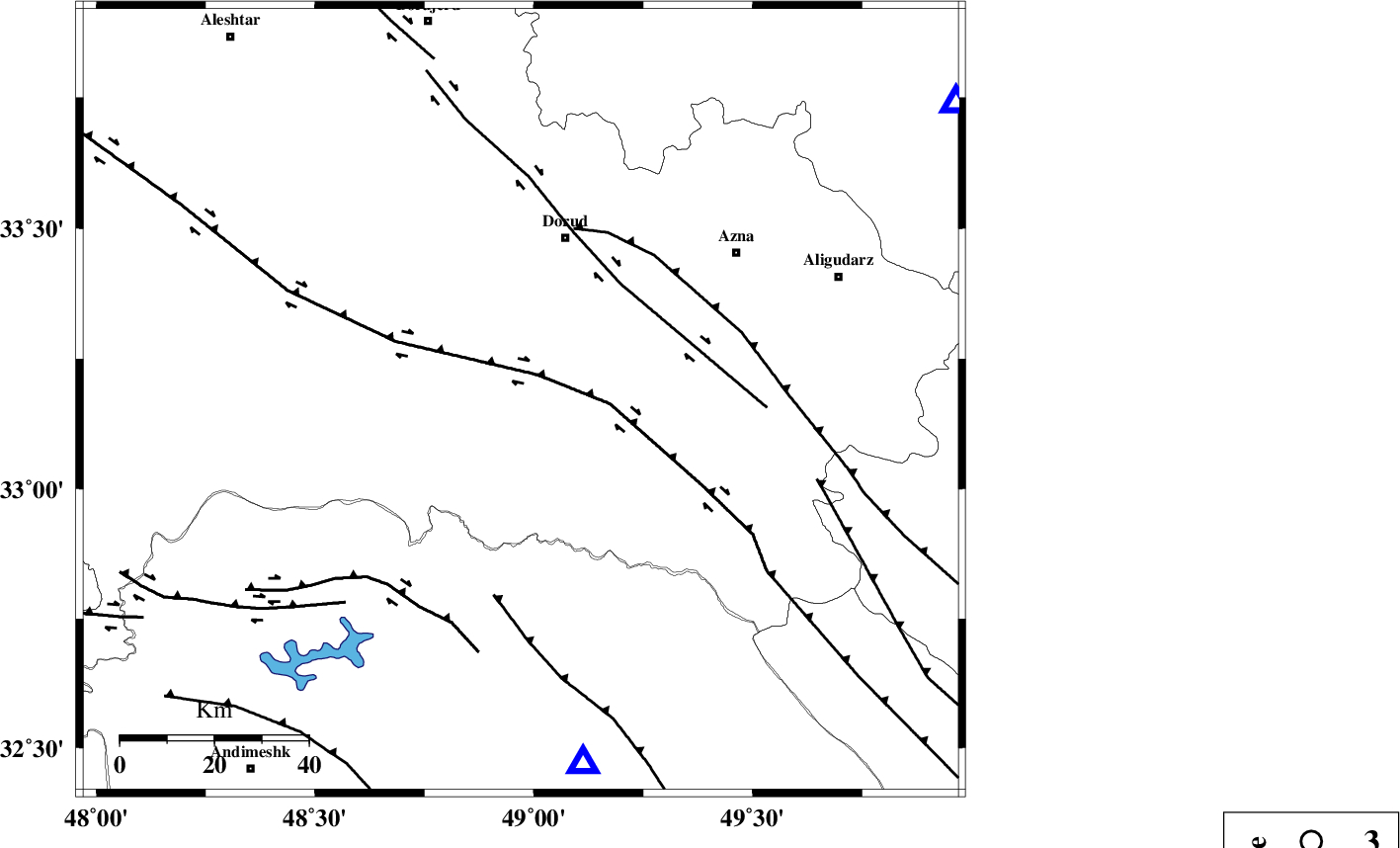
| Location | Lat:33.17 Lon: 48.97 |
| Region | Lorestan Province, 35 km South of Dorud |
Nearest Cities |
|
| 11 km South of Sartang barzeh, Lorestan Province | |
| 14 km North of Bargsar, Lorestan Province | |
| 15 km East of Chamsangar, Lorestan Province | |
| 19 km West of Shulabad, Lorestan Province | |
| 36 km South West of Dorud, Lorestan Province | |
| Depth | 14 km |
| Agency | |
Faults within 150 km: |
|
| HZF4 (Length: 492 km) , Distance to epicenter: 7 km | |
| DORUD (Length: 100 km) , Distance to epicenter: 33 km | |
| MAIN_ZAGROS_R_F (Length: 1106 km) , Distance to epicenter: 38 km | |
| Number of Phases | 4 |
| RMS | 0.1 |
| Number of Stations | 4 |
| Error in Latitude | >4.1 km |
| Error in Longitude | 9.9 km |
| Error in Depth | 4.8 km |
Download waveform in seisan format
to download seisan software Click here
to access information about IIEES stations Click here
Amplitude | ||||||||
| UID | Agency | Station | Component | Amplitude | Period | Arrival Time | Proccessing Time | Signal Clip |
| 92327 | IIEES | SHGR | E | 539.8 | 0.48 | 2014-05-03 16:25:23 | 2014-05-03 05:41:00 | n |
| 92328 | IIEES | SHGR | N | 401 | 0.48 | 2014-05-03 16:25:30 | 2014-05-03 05:41:00 | n |
| 92329 | IIEES | GHVR | E | 89.3 | 0.44 | 2014-05-03 16:26:07 | 2014-05-03 05:41:00 | n |
Phase | ||||||||||||
| Agency | Station | Component | Phase Type | Phase Quality | First Motion | Observed Arrival Time | Time Residual | Loc. Flag | Input Weight | Distance | Azimuth | |
| IIEES | KHMZ | Z | Pg | E | 2014-05-03 16:25:01 | -0.1 | y | 111 | 55 | |||
| IIEES | SHGR | Z | Pg | E | 2014-05-03 16:25:03 | -0.01 | y | 119 | 188 | |||
| IIEES | ASAO | Z | Pg | E | 2014-05-03 16:25:13 | -0.03 | y | 181 | 32 | |||
| IIEES | GHVR | Z | Pn | E | 2014-05-03 16:25:22 | 0.14 | y | 255 | 55 | |||