
Magnitude |
:4.4 |
| Date & Time (UTC) | 2014-04-24 07:41:08.3 |
| Date & Time (Local) | 1393/2/4 12:11:08.3 |
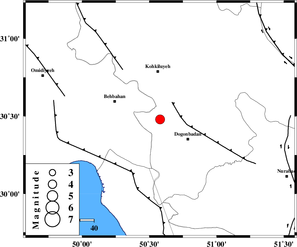
| Location | Lat:30.48 Lon: 50.58 |
| Region | Kohkiluieh va boyerahmad Province, 34 km South of Dehdasht |
Nearest Cities |
|
| 24 km North West of Dogonbadan, Kohkiluieh va boyerahmad Province | |
| 32 km South East of Mansuriyeh, Khoozestan Province | |
| 34 km South of Dehdasht, Kohkiluieh va boyerahmad Province | |
| 35 km South East of Behbahan, Khoozestan Province | |
| 39 km North East of Sardasht, Khoozestan Province | |
| Depth | 15 km |
| Agency | |
Faults within 150 km: |
|
| MISHAN_F (Length: 76 km) , Distance to epicenter: 15 km | |
| ZFF3 (Length: 125 km) , Distance to epicenter: 43 km | |
| RAG_E_SEFID_F (Length: 84 km) , Distance to epicenter: 43 km | |
| Number of Phases | 7 |
| RMS | 0.2 |
| Number of Stations | 5 |
| Error in Latitude | >4.8 km |
| Error in Longitude | 7.8 km |
| Error in Depth | 8 km |
Download waveform in seisan format
to download seisan software Click here
to access information about IIEES stations Click here
Amplitude | ||||||||
| UID | Agency | Station | Component | Amplitude | Period | Arrival Time | Proccessing Time | Signal Clip |
| 92278 | IIEES | SHGR | N | 2211.4 | 0.45 | 2014-04-24 07:42:28 | 2014-04-26 12:21:00 | n |
| 92279 | IIEES | SHGR | E | 2879 | 0.56 | 2014-04-24 07:42:31 | 2014-04-26 12:21:00 | n |
Phase | ||||||||||||
| Agency | Station | Component | Phase Type | Phase Quality | First Motion | Observed Arrival Time | Time Residual | Loc. Flag | Input Weight | Distance | Azimuth | |
| IIEES | AHRM | Z | Pg | E | 2014-04-24 07:41:40 | 0.12 | y | 192 | 159 | |||
| IIEES | AHRM | N | Sg | E | 2014-04-24 07:42:03 | 0.08 | y | 192 | 159 | |||
| IIEES | SHGR | Z | Pn | E | 2014-04-24 07:41:46 | 0.06 | y | 247 | 317 | |||
| IIEES | SHGR | E | Sg | E | 2014-04-24 07:42:17 | -0.19 | y | 247 | 317 | |||
| IIEES | GHIR | Z | Pn | E | 2014-04-24 07:41:57 | -0.35 | y | 338 | 136 | |||
| IIEES | KHMZ | Z | Pn | E | 2014-04-24 07:42:01 | 0.42 | y | 366 | 351 | |||
| IIEES | KRBR | Z | Pn | E | 2014-04-24 07:42:30 | -0.18 | y | 597 | 94 | |||