
Magnitude |
:2.8 |
| Date & Time (UTC) | 2014-04-23 00:45:57.4 |
| Date & Time (Local) | 1393/2/3 05:15:57.4 |
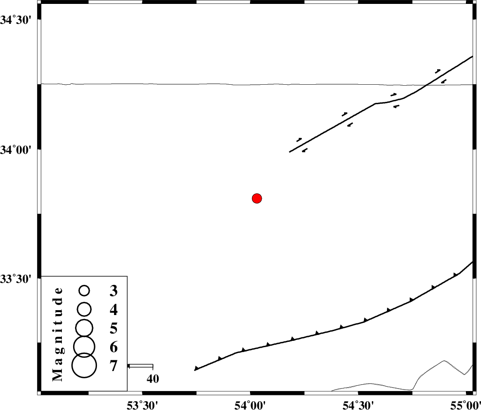
| Location | Lat:33.81 Lon: 54.03 |
| Region | Esfahan Province, 167 km North of Ardakan |
Nearest Cities |
|
| 38 km North West of Chupanan, Esfahan Province | |
| 44 km South West of Jondaq, Esfahan Province | |
| 63 km North East of Anarak, Esfahan Province | |
| 65 km North East of Maedan, Esfahan Province | |
| 84 km West of Farrokhi, Esfahan Province | |
| Depth | 14 km |
| Agency | |
Faults within 150 km: |
|
| DORUNEH_F (Length: 713 km) , Distance to epicenter: 24 km | |
| BIABANAK_F (Length: 162 km) , Distance to epicenter: 63 km | |
| CHAH_ZANGUL_F (Length: 123 km) , Distance to epicenter: 115 km | |
| Number of Phases | 4 |
| RMS | 0.1 |
| Number of Stations | 4 |
| Error in Latitude | >2 km |
| Error in Longitude | 10.5 km |
| Error in Depth | 4.6 km |
Download waveform in seisan format
to download seisan software Click here
to access information about IIEES stations Click here
Amplitude | ||||||||
| UID | Agency | Station | Component | Amplitude | Period | Arrival Time | Proccessing Time | Signal Clip |
| 92253 | IIEES | YZKH | N | 151.2 | 0.64 | 2014-04-23 00:46:49 | 2014-04-23 03:16:00 | n |
| 92254 | IIEES | GHVR | N | 40.7 | 0.68 | 2014-04-23 00:47:14 | 2014-04-23 03:16:00 | n |
Phase | ||||||||||||
| Agency | Station | Component | Phase Type | Phase Quality | First Motion | Observed Arrival Time | Time Residual | Loc. Flag | Input Weight | Distance | Azimuth | |
| IIEES | YZKH | Z | Pg | E | 2014-04-23 00:46:25 | 0.01 | y | 166 | 162 | |||
| IIEES | YZKH | N | Sg | E | 2014-04-23 00:46:45 | -0.05 | y | 166 | 162 | |||
| IIEES | TABS | Z | Pn | E | 2014-04-23 00:46:40 | 0.1 | y | 287 | 93 | |||
| IIEES | SHRO | E | Sg | E | 2014-04-23 00:47:22 | -0.06 | y | 303 | 36 | |||