
Magnitude |
:3.4 |
| Date & Time (UTC) | 2014-04-12 22:09:32.0 |
| Date & Time (Local) | 1393/1/24 02:39:32.0 |
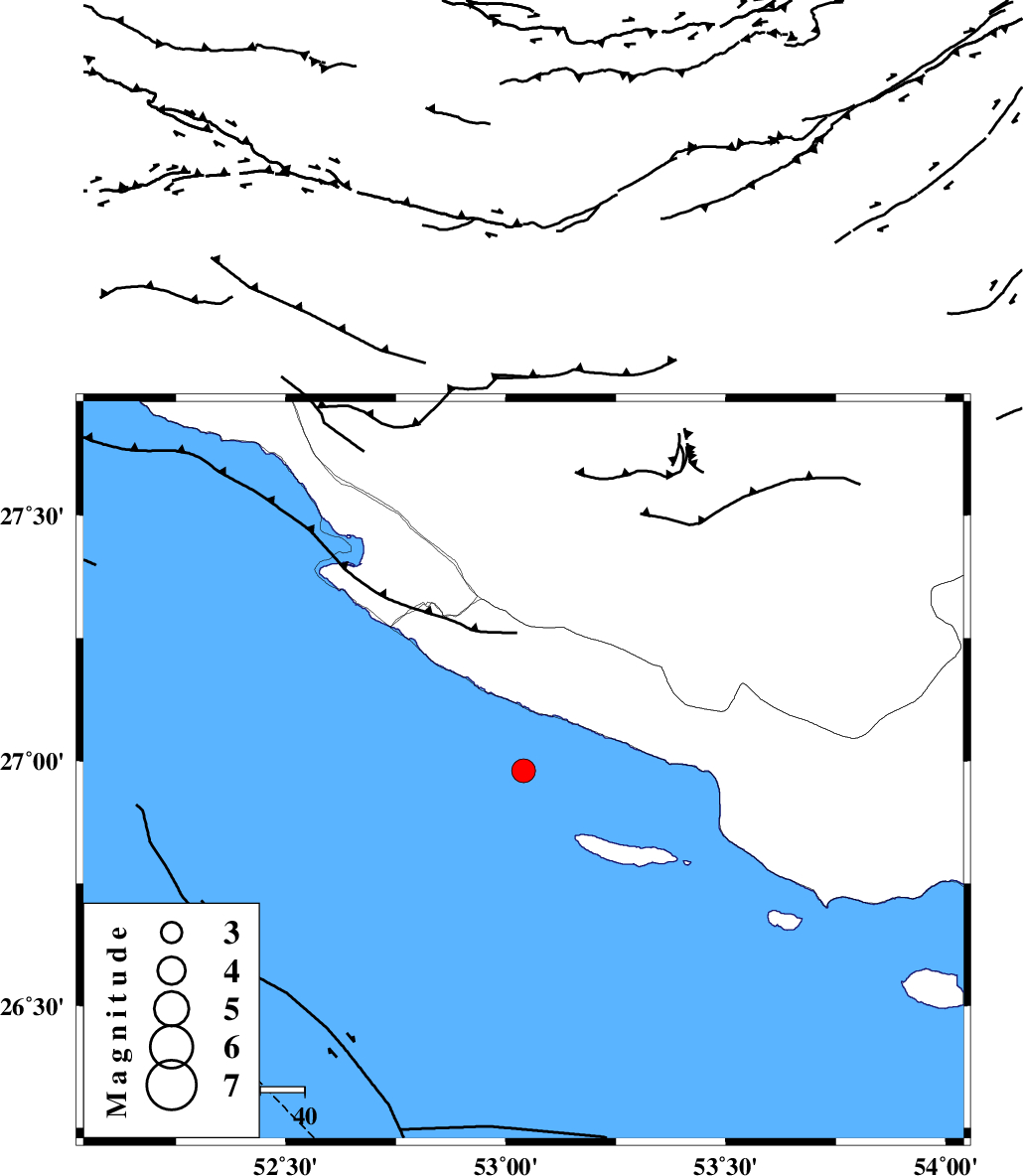
| Location | Lat:26.98 Lon: 53.04 |
| Region | Persian Gulf, 42 km South-West of Lamerd |
Nearest Cities |
|
| 41 km South West of Lamerd, Fars Province | |
| 49 km South East of Chah-e mobarak, Bushehr Province | |
| 52 km South of Khoozi, Fars Province | |
| 63 km South West of Ashkenan, Fars Province | |
| 65 km South East of Mehr, Fars Province | |
| Depth | 18 km |
| Agency | |
Faults within 150 km: |
|
| MFF3 (Length: 292 km) , Distance to epicenter: 26 km | |
| ZFF1 (Length: 165 km) , Distance to epicenter: 76 km | |
| MFF1 (Length: 180 km) , Distance to epicenter: 100 km | |
| Number of Phases | 4 |
| RMS | 0.1 |
| Number of Stations | 3 |
| Error in Latitude | >18.4 km |
| Error in Longitude | 22.8 km |
| Error in Depth | 28.6 km |
Download waveform in seisan format
to download seisan software Click here
to access information about IIEES stations Click here
Amplitude | ||||||||
| UID | Agency | Station | Component | Amplitude | Period | Arrival Time | Proccessing Time | Signal Clip |
| 92210 | IIEES | KRBR | N | 35.7 | 0.32 | 2014-04-12 22:11:40 | 2014-04-13 04:18:00 | n |
Phase | ||||||||||||
| Agency | Station | Component | Phase Type | Phase Quality | First Motion | Observed Arrival Time | Time Residual | Loc. Flag | Input Weight | Distance | Azimuth | |
| IIEES | AHRM | Z | Pg | E | 2014-04-12 22:10:16 | -0.01 | y | 271 | 321 | |||
| IIEES | AHRM | N | Sg | E | 2014-04-12 22:10:48 | 0.02 | y | 271 | 321 | |||
| IIEES | KRBR | Z | Pn | E | 2014-04-12 22:10:40 | 0.07 | y | 494 | 47 | |||
| IIEES | YZKH | Z | Pn | E | 2014-04-12 22:10:56 | -0.1 | y | 619 | 14 | |||