
Magnitude |
:3.1 |
| Date & Time (UTC) | 2014-04-06 17:15:37.4 |
| Date & Time (Local) | 1393/1/17 21:45:37.4 |
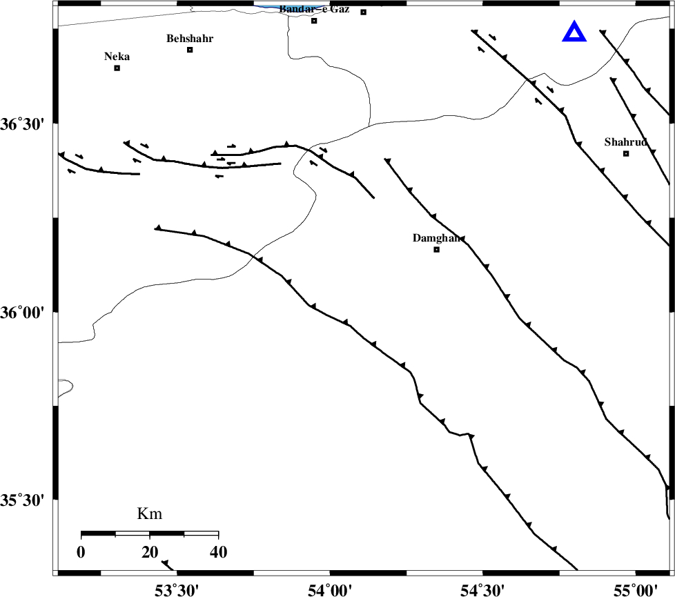
| Location | Lat:36.06 Lon: 54.11 |
| Region | Semnan Province, 25 km South-West of Damghan |
Nearest Cities |
|
| 4 km North of Seydabad, Semnan Province | |
| 5 km North of Amirabad, Semnan Province | |
| 19 km North East of Darvar, Semnan Province | |
| 24 km South West of Damghan, Semnan Province | |
| 40 km South East of Talma darreh, Mazandaran Province | |
| Depth | 15 km |
| Agency | |
Faults within 150 km: |
|
| ATARI_F (Length: 185 km) , Distance to epicenter: 4 km | |
| DAMGHAN_F (Length: 95 km) , Distance to epicenter: 15 km | |
| ASTANEH_F (Length: 72 km) , Distance to epicenter: 22 km | |
| Number of Phases | 7 |
| RMS | 0.1 |
| Number of Stations | 5 |
| Error in Latitude | >3.2 km |
| Error in Longitude | 1.2 km |
| Error in Depth | 3.1 km |
Download waveform in seisan format
to download seisan software Click here
to access information about IIEES stations Click here
Amplitude | ||||||||
| UID | Agency | Station | Component | Amplitude | Period | Arrival Time | Proccessing Time | Signal Clip |
| 92171 | IIEES | GHVR | E | 62.5 | 0.52 | 2014-04-06 17:17:11 | 2014-04-06 07:32:00 | n |
Phase | ||||||||||||
| Agency | Station | Component | Phase Type | Phase Quality | First Motion | Observed Arrival Time | Time Residual | Loc. Flag | Input Weight | Distance | Azimuth | |
| IIEES | SHRO | E | Pn | E | 2014-04-06 17:16:06 | 0.02 | y | 172 | 91 | |||
| IIEES | SHRO | E | Sg | E | 2014-04-06 17:16:26 | 0.01 | y | 172 | 91 | |||
| IIEES | GHVR | Z | Pn | E | 2014-04-06 17:16:24 | 0.13 | y | 314 | 237 | |||
| IIEES | GHVR | E | Sg | E | 2014-04-06 17:17:05 | -0.01 | y | 314 | 237 | |||
| IIEES | TABS | Z | Pn | E | 2014-04-06 17:16:32 | -0.06 | y | 384 | 133 | |||
| IIEES | ASAO | Z | Pn | E | 2014-04-06 17:16:35 | -0.09 | y | 407 | 247 | |||
| IIEES | ZNJK | Z | Pn | E | 2014-04-06 17:16:46 | -0.03 | y | 491 | 280 | |||