
Magnitude |
:2.5 |
| Date & Time (UTC) | 2014-04-04 17:17:12.1 |
| Date & Time (Local) | 1393/1/15 21:47:12.1 |
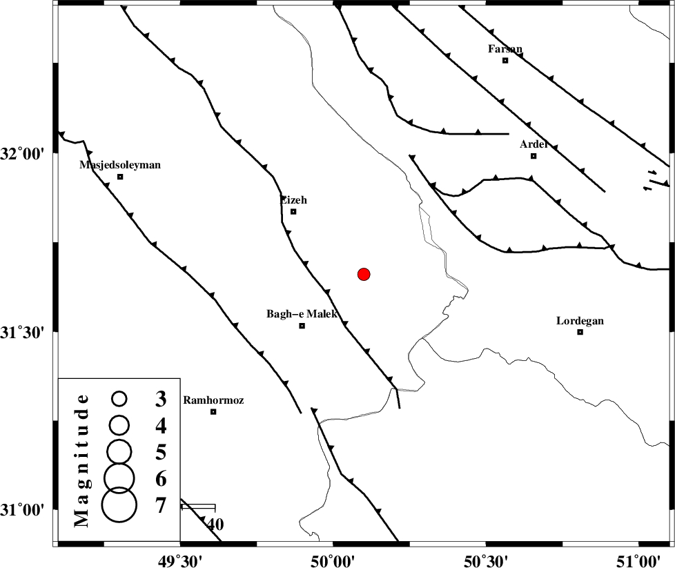
| Location | Lat:31.66 Lon: 50.1 |
| Region | Khoozestan Province, 25 km North-East of Bagh Malek |
Nearest Cities |
|
| 16 km North East of Abolabbas, Khoozestan Province | |
| 19 km West of Dehdez, Khoozestan Province | |
| 20 km North East of Ghaleh tal, Khoozestan Province | |
| 25 km North East of Bagh Malek, Khoozestan Province | |
| 29 km South East of Izeh, Khoozestan Province | |
| Depth | 14 km |
| Agency | |
Faults within 150 km: |
|
| MFF2 (Length: 205 km) , Distance to epicenter: 13 km | |
| SABZKUH_F (Length: 67 km) , Distance to epicenter: 33 km | |
| DOPOLAN_F (Length: 107 km) , Distance to epicenter: 35 km | |
| Number of Phases | 5 |
| RMS | 0.1 |
| Number of Stations | 3 |
| Error in Latitude | >3.6 km |
| Error in Longitude | 3.9 km |
| Error in Depth | 6.2 km |
Download waveform in seisan format
to download seisan software Click here
to access information about IIEES stations Click here
Amplitude | ||||||||
| UID | Agency | Station | Component | Amplitude | Period | Arrival Time | Proccessing Time | Signal Clip |
| 92147 | IIEES | SHGR | N | 81.4 | 0.39 | 2014-04-04 17:17:53 | 2014-04-04 06:38:00 | n |
| 92148 | IIEES | SHGR | E | 95.4 | 0.2 | 2014-04-04 17:17:53 | 2014-04-04 06:38:00 | n |
Phase | ||||||||||||
| Agency | Station | Component | Phase Type | Phase Quality | First Motion | Observed Arrival Time | Time Residual | Loc. Flag | Input Weight | Distance | Azimuth | |
| IIEES | SHGR | Z | Pg | E | 2014-04-04 17:17:34 | -0.06 | y | 133 | 292 | |||
| IIEES | SHGR | E | Sg | E | 2014-04-04 17:17:50 | 0.04 | y | 133 | 292 | |||
| IIEES | KHMZ | Z | Pn | E | 2014-04-04 17:17:48 | -0.06 | y | 231 | 357 | |||
| IIEES | KHMZ | E | Sg | E | 2014-04-04 17:18:17 | -0.02 | y | 231 | 357 | |||
| IIEES | ASAO | Z | Pn | E | 2014-04-04 17:17:59 | 0.12 | y | 321 | 359 | |||