
Magnitude |
:2.8 |
| Date & Time (UTC) | 2014-04-03 07:24:16.0 |
| Date & Time (Local) | 1393/1/14 11:54:16.0 |
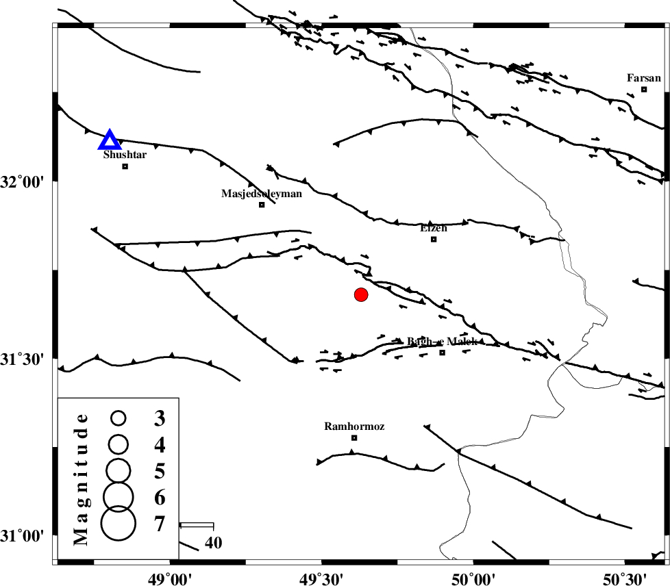
| Location | Lat:31.68 Lon: 49.63 |
| Region | Khoozestan Province, 29 km South-West of Izeh |
Nearest Cities |
|
| 17 km North of Jaru, Khoozestan Province | |
| 19 km South West of Chenarestan, Khoozestan Province | |
| 25 km North West of Ghaleh tal, Khoozestan Province | |
| 27 km South West of Rasvand, Khoozestan Province | |
| 27 km North of Midavood-e sofla, Khoozestan Province | |
| Depth | 14 km |
| Agency | |
Faults within 150 km: |
|
| DEZFUL_EMBAYMENT (Length: 228 km) , Distance to epicenter: 10 km | |
| MFF2 (Length: 205 km) , Distance to epicenter: 24 km | |
| MFF4 (Length: 62 km) , Distance to epicenter: 52 km | |
| Number of Phases | 4 |
| RMS | 0.3 |
| Number of Stations | 4 |
| Error in Latitude | >10.9 km |
| Error in Longitude | 36.8 km |
| Error in Depth | 14.2 km |
Download waveform in seisan format
to download seisan software Click here
to access information about IIEES stations Click here
Amplitude | ||||||||
| UID | Agency | Station | Component | Amplitude | Period | Arrival Time | Proccessing Time | Signal Clip |
| 92127 | IIEES | SHGR | N | 309.2 | 0.44 | 2014-04-03 07:24:53 | 2014-04-03 08:58:00 | n |
| 92128 | IIEES | SHGR | E | 358.2 | 0.56 | 2014-04-03 07:24:54 | 2014-04-03 08:58:00 | n |
Phase | ||||||||||||
| Agency | Station | Component | Phase Type | Phase Quality | First Motion | Observed Arrival Time | Time Residual | Loc. Flag | Input Weight | Distance | Azimuth | |
| IIEES | KHMZ | Z | Pg | E | 2014-04-03 07:24:53 | -0.52 | y | 230 | 8 | |||
| IIEES | KHMZ | N | Sg | E | 2014-04-03 07:25:21 | 0.12 | y | 230 | 8 | |||
| IIEES | ASAO | Z | Pn | E | 2014-04-03 07:25:04 | 0.41 | y | 320 | 7 | |||
| IIEES | GHVR | Z | Pn | E | 2014-04-03 07:25:06 | 0.03 | y | 345 | 26 | |||