
Magnitude |
:2.8 |
| Date & Time (UTC) | 2014-04-01 17:59:30.1 |
| Date & Time (Local) | 1393/1/12 22:29:30.1 |
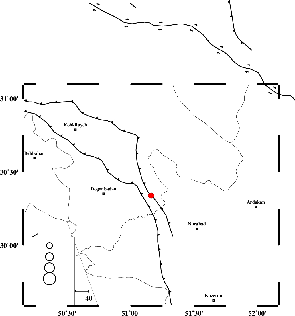
| Location | Lat:30.34 Lon: 51.16 |
| Region | Kohkiluieh va boyerahmad Province, 36 km East of Dogonbadan |
Nearest Cities |
|
| 2 km of Basht, Kohkiluieh va boyerahmad Province | |
| 13 km North West of Kopon olia, Fars Province | |
| 16 km South East of Abdehgah, Kohkiluieh va boyerahmad Province | |
| 22 km West of Chehar taq, Fars Province | |
| 22 km North West of Dehnumoqimi, Fars Province | |
| Depth | 18 km |
| Agency | |
Faults within 150 km: |
|
| MISHAN_F (Length: 76 km) , Distance to epicenter: 11 km | |
| KAZERUN_F (Length: 96 km) , Distance to epicenter: 33 km | |
| DENA_F (Length: 137 km) , Distance to epicenter: 66 km | |
| Number of Phases | 5 |
| RMS | 0 |
| Number of Stations | 4 |
| Error in Latitude | >4.5 km |
| Error in Longitude | 4.4 km |
| Error in Depth | 13.9 km |
Download waveform in seisan format
to download seisan software Click here
to access information about IIEES stations Click here
Amplitude | ||||||||
| UID | Agency | Station | Component | Amplitude | Period | Arrival Time | Proccessing Time | Signal Clip |
| 92110 | IIEES | AHRM | N | 136.2 | 0.68 | 2014-04-01 18:00:22 | 2014-04-01 09:15:00 | n |
| 92111 | IIEES | AHRM | E | 125.6 | 0.48 | 2014-04-01 18:00:27 | 2014-04-01 09:15:00 | n |
| 92112 | IIEES | ASAO | N | 12.6 | 0.56 | 2014-04-01 18:01:31 | 2014-04-01 09:15:00 | n |
| 92113 | IIEES | ASAO | E | 10 | 0.56 | 2014-04-01 18:01:32 | 2014-04-01 09:15:00 | n |
Phase | ||||||||||||
| Agency | Station | Component | Phase Type | Phase Quality | First Motion | Observed Arrival Time | Time Residual | Loc. Flag | Input Weight | Distance | Azimuth | |
| IIEES | AHRM | Z | Pg | E | 2014-04-01 17:59:57 | 0.04 | y | 164 | 175 | |||
| IIEES | AHRM | E | Sg | E | 2014-04-01 18:00:16 | -0.03 | y | 164 | 175 | |||
| IIEES | KHMZ | Z | Pn | E | 2014-04-01 18:00:26 | 0.04 | y | 394 | 344 | |||
| IIEES | YZKH | Z | Pn | E | 2014-04-01 18:00:27 | 0 | y | 398 | 54 | |||
| IIEES | ASAO | Z | Pn | E | 2014-04-01 18:00:37 | -0.05 | y | 479 | 347 | |||