
Magnitude |
:1.9 |
| Date & Time (UTC) | 2014-03-29 20:07:52.0 |
| Date & Time (Local) | 1393/1/10 00:37:52.0 |
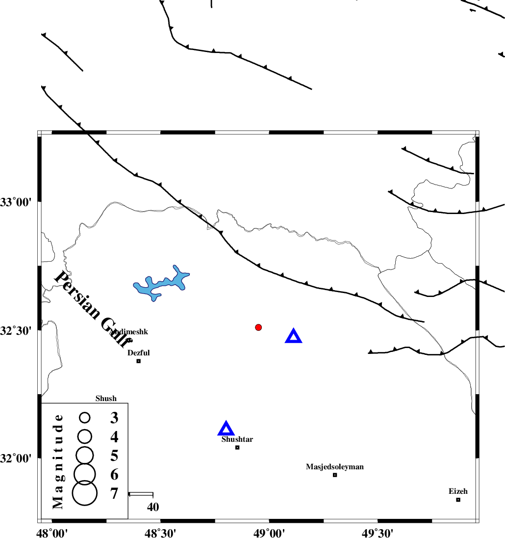
| Location | Lat:32.51 Lon: 48.95 |
| Region | Khoozestan Province, 21 km North-West of Lali |
Nearest Cities |
|
| 11 km North East of Sardasht, Khoozestan Province | |
| 20 km North West of Lali, Khoozestan Province | |
| 30 km North East of Mahur berenji, Khoozestan Province | |
| 31 km North West of Jaefarabad, Khoozestan Province | |
| 32 km North East of Gatvand, Khoozestan Province | |
| Depth | 15 km |
| Agency | |
Faults within 150 km: |
|
| MFF2 (Length: 205 km) , Distance to epicenter: 18 km | |
| BALARUD_F_Z2 (Length: 58 km) , Distance to epicenter: 21 km | |
| DEZFUL_EMBAYMENT (Length: 228 km) , Distance to epicenter: 25 km | |
| Number of Phases | 3 |
| RMS | 0 |
| Number of Stations | 3 |
| Error in Latitude | >5.6 km |
| Error in Longitude | 14.9 km |
| Error in Depth | 0 km |
Download waveform in seisan format
to download seisan software Click here
to access information about IIEES stations Click here
Amplitude | ||||||||
| UID | Agency | Station | Component | Amplitude | Period | Arrival Time | Proccessing Time | Signal Clip |
| 92088 | IIEES | SHGR | E | 113.7 | 0.28 | 2014-03-29 20:08:09 | 2014-03-30 03:21:00 | n |
Phase | ||||||||||||
| Agency | Station | Component | Phase Type | Phase Quality | First Motion | Observed Arrival Time | Time Residual | Loc. Flag | Input Weight | Distance | Azimuth | |
| IIEES | SHGR | Z | Pg | E | 2014-03-29 20:08:00 | 0 | y | 46.9 | 197 | |||
| IIEES | KHMZ | Z | Pg | E | 2014-03-29 20:08:19 | 0 | y | 166 | 35 | |||
| IIEES | ASAO | Z | Pn | E | 2014-03-29 20:08:30 | 0 | y | 247 | 24 | |||