
Magnitude |
:4 |
| Date & Time (UTC) | 2014-03-20 21:07:17.1 |
| Date & Time (Local) | 1393/1/1 00:37:17.1 |
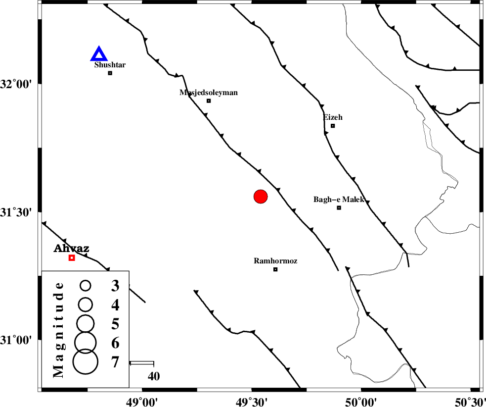
| Location | Lat:31.56 Lon: 49.54 |
| Region | Khoozestan Province, 32 km North of Ramhormoz |
Nearest Cities |
|
| 1 km North of Jaru, Khoozestan Province | |
| 13 km North of Haftgol, Khoozestan Province | |
| 15 km North East of Gazin, Khoozestan Province | |
| 21 km North West of Midavood-e sofla, Khoozestan Province | |
| 32 km North of Ramhormoz, Khoozestan Province | |
| Depth | 17 km |
| Agency | |
Faults within 150 km: |
|
| DEZFUL_EMBAYMENT (Length: 228 km) , Distance to epicenter: 8 km | |
| MFF2 (Length: 205 km) , Distance to epicenter: 37 km | |
| MFF4 (Length: 62 km) , Distance to epicenter: 48 km | |
| Number of Phases | 6 |
| RMS | 0 |
| Number of Stations | 5 |
| Error in Latitude | >1.5 km |
| Error in Longitude | 3.2 km |
| Error in Depth | 4.7 km |
Download waveform in seisan format
to download seisan software Click here
to access information about IIEES stations Click here
Amplitude | ||||||||
| UID | Agency | Station | Component | Amplitude | Period | Arrival Time | Proccessing Time | Signal Clip |
| 92030 | IIEES | ASAO | E | 432.7 | 0.88 | 2014-03-20 21:08:56 | 2014-03-20 10:30:00 | n |
Phase | ||||||||||||
| Agency | Station | Component | Phase Type | Phase Quality | First Motion | Observed Arrival Time | Time Residual | Loc. Flag | Input Weight | Distance | Azimuth | |
| IIEES | SHGR | Z | Pg | E | 2014-03-20 21:07:32 | 0.02 | y | 93.1 | 311 | |||
| IIEES | ASAO | Z | Pn | E | 2014-03-20 21:08:06 | -0.02 | y | 335 | 8 | |||
| IIEES | ASAO | N | Sg | E | 2014-03-20 21:08:51 | -0.02 | y | 335 | 8 | |||
| IIEES | AHRM | Z | Pn | E | 2014-03-20 21:08:06 | -0.03 | y | 343 | 150 | |||
| IIEES | GHVR | Z | Pn | E | 2014-03-20 21:08:09 | 0.02 | y | 361 | 26 | |||
| IIEES | TABS | Z | Pn | E | 2014-03-20 21:08:57 | 0.07 | y | 748 | 70 | |||