
Magnitude |
:2.7 |
| Date & Time (UTC) | 2014-03-09 07:06:19.9 |
| Date & Time (Local) | 1392/12/18 10:36:19.9 |
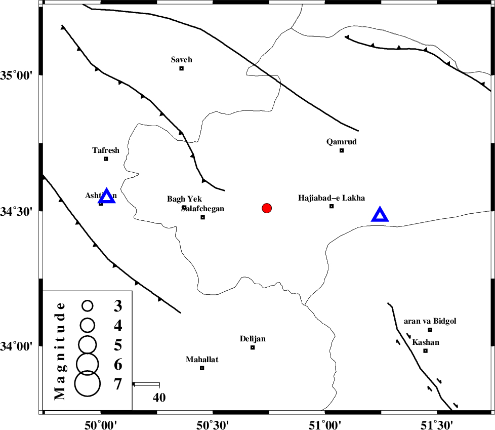
| Location | Lat:34.51 Lon: 50.74 |
| Region | Qom Province, 19 km South-West of Qom |
Nearest Cities |
|
| 19 km North West of Kahak, Qom Province | |
| 19 km South West of Qom, Qom Province | |
| 26 km North East of Salafchegan, Qom Province | |
| 27 km West of Hajiabad-e lakha, Qom Province | |
| 34 km East of Bagh yek, Qom Province | |
| Depth | 14 km |
| Agency | |
Faults within 150 km: |
|
| INDES_F (Length: 98 km) , Distance to epicenter: 19 km | |
| KUSHK_E_NOSRAT_F (Length: 230 km) , Distance to epicenter: 46 km | |
| TAFRESH_F (Length: 117 km) , Distance to epicenter: 56 km | |
| Number of Phases | 8 |
| RMS | 0.3 |
| Number of Stations | 5 |
| Error in Latitude | >2.7 km |
| Error in Longitude | 2.2 km |
| Error in Depth | 9.5 km |
Download waveform in seisan format
to download seisan software Click here
to access information about IIEES stations Click here
Amplitude | ||||||||
| UID | Agency | Station | Component | Amplitude | Period | Arrival Time | Proccessing Time | Signal Clip |
| 91958 | IIEES | GHVR | E | 636 | 0.25 | 2014-03-09 07:06:36 | 2014-03-09 07:31:00 | n |
| 91959 | IIEES | CHTH | N | 92.9 | 0.2 | 2014-03-09 07:07:09 | 2014-03-09 07:31:00 | n |
| 91960 | IIEES | CHTH | E | 126.2 | 0.33 | 2014-03-09 07:07:09 | 2014-03-09 07:31:00 | n |
Phase | ||||||||||||
| Agency | Station | Component | Phase Type | Phase Quality | First Motion | Observed Arrival Time | Time Residual | Loc. Flag | Input Weight | Distance | Azimuth | |
| IIEES | GHVR | Z | Pg | E | 2014-03-09 07:06:28 | -0.02 | y | 46.5 | 94 | |||
| IIEES | GHVR | N | Sg | E | 2014-03-09 07:06:34 | 0.23 | y | 46.5 | 94 | |||
| IIEES | ASAO | Z | Pg | E | 2014-03-09 07:06:32 | 0.5 | y | 65.7 | 273 | |||
| IIEES | ASAO | E | Sg | E | 2014-03-09 07:06:40 | -0.04 | y | 65.7 | 273 | |||
| IIEES | KHMZ | Z | Pg | E | 2014-03-09 07:06:38 | -0.48 | y | 112 | 220 | |||
| IIEES | CHTH | Z | Pg | E | 2014-03-09 07:06:45 | -0.35 | y | 159 | 13 | |||
| IIEES | CHTH | N | Sg | E | 2014-03-09 07:07:05 | -0.11 | y | 159 | 13 | |||
| IIEES | ZNJK | Z | Pn | E | 2014-03-09 07:07:05 | 0.29 | y | 303 | 323 | |||