
Magnitude |
:2.9 |
| Date & Time (UTC) | 2014-03-02 18:48:11.8 |
| Date & Time (Local) | 1392/12/11 22:18:11.8 |
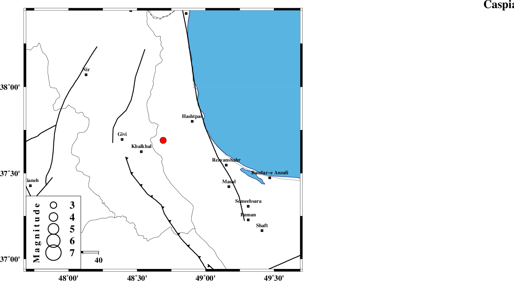
| Location | Lat:37.69 Lon: 48.69 |
| Region | Gilan Province, 16 km East of Khalkhal |
Nearest Cities |
|
| 15 km North East of Khojin, Ardebil Province | |
| 16 km North East of Khalkhal, Ardebil Province | |
| 18 km South West of Kish dini, Gilan Province | |
| 22 km South West of Hashtpar, Gilan Province | |
| 23 km West of Tularud, Gilan Province | |
| Depth | 18 km |
| Agency | |
Faults within 150 km: |
|
| MASULEL_F (Length: 90 km) , Distance to epicenter: 26 km | |
| TALESH_F (Length: 258 km) , Distance to epicenter: 28 km | |
| SANGAVAR_F (Length: 61 km) , Distance to epicenter: 31 km | |
| Number of Phases | 5 |
| RMS | 0 |
| Number of Stations | 3 |
| Error in Latitude | >1.7 km |
| Error in Longitude | 3.1 km |
| Error in Depth | 3.9 km |
Download waveform in seisan format
to download seisan software Click here
to access information about IIEES stations Click here
Amplitude | ||||||||
| UID | Agency | Station | Component | Amplitude | Period | Arrival Time | Proccessing Time | Signal Clip |
| 91906 | IIEES | GRMI | E | 235.2 | 0.16 | 2014-03-02 18:48:54 | 2014-03-02 07:14:00 | n |
| 91907 | IIEES | GRMI | N | 212.8 | 0.16 | 2014-03-02 18:48:54 | 2014-03-02 07:14:00 | n |
Phase | ||||||||||||
| Agency | Station | Component | Phase Type | Phase Quality | First Motion | Observed Arrival Time | Time Residual | Loc. Flag | Input Weight | Distance | Azimuth | |
| IIEES | ZNJK | Z | Pg | E | 2014-03-02 18:48:31 | 0.02 | y | 113 | 180 | |||
| IIEES | GRMI | Z | Pg | E | 2014-03-02 18:48:35 | -0.06 | y | 142 | 331 | |||
| IIEES | GRMI | N | Sg | E | 2014-03-02 18:48:52 | 0.06 | y | 142 | 331 | |||
| IIEES | CHTH | Z | Pn | E | 2014-03-02 18:48:55 | -0.05 | y | 294 | 132 | |||
| IIEES | CHTH | N | Sg | E | 2014-03-02 18:49:34 | 0.04 | y | 294 | 132 | |||