
Magnitude |
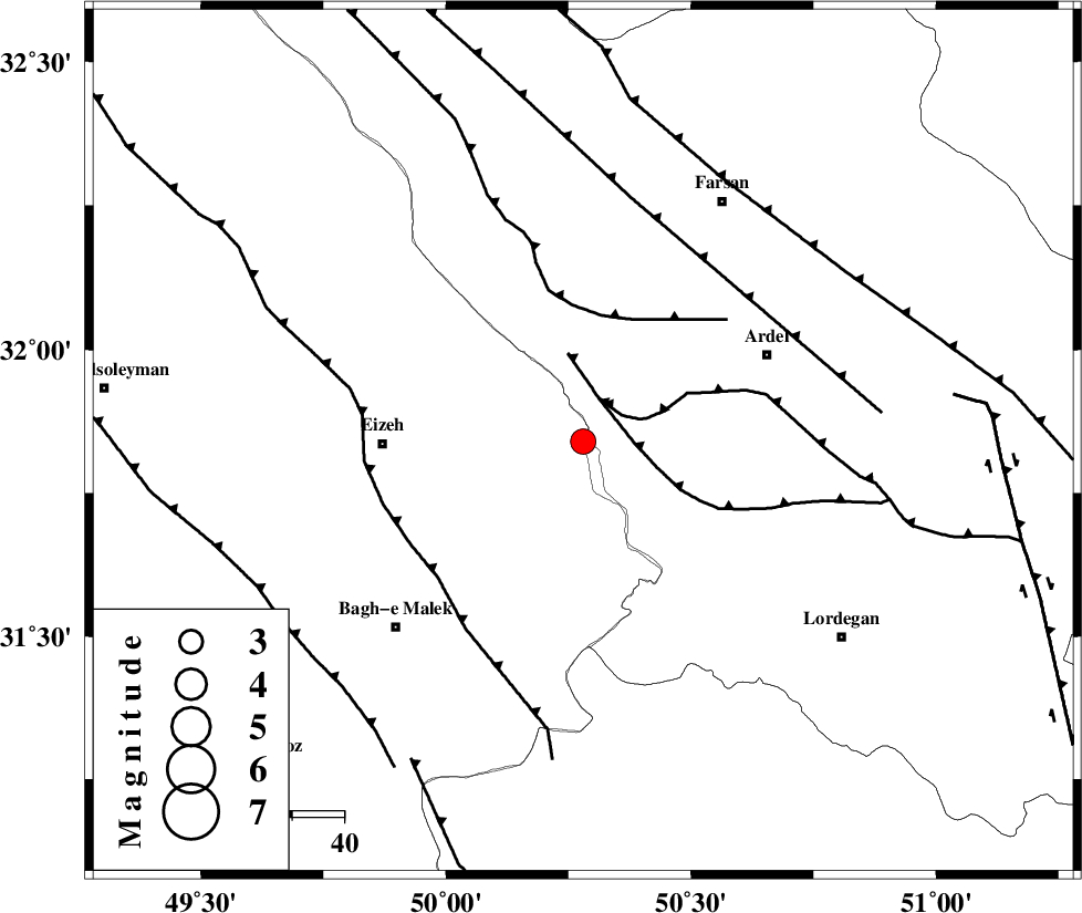
:3.2 |
| Date & Time (UTC) | 2014-02-20 09:41:14.5 |
| Date & Time (Local) | 1392/12/1 13:11:14.5 |
| Location | Lat:31.84 Lon: 50.28 |
| Region | Khoozestan Province, 39 km East of Izeh |
Nearest Cities |
|
| 10 km North of Dehdez, Khoozestan Province | |
| 27 km North West of Sarkhun, Chaharmahal Bakhtiari Province | |
| 32 km West of Dupelan, Chaharmahal Bakhtiari Province | |
| 37 km South West of Rostamabad, Chaharmahal Bakhtiari Province | |
| 39 km North East of Izeh, Khoozestan Province | |
| Depth | 14 km |
| Agency | |
Faults within 150 km: |
|
| SABZKUH_F (Length: 67 km) , Distance to epicenter: 9 km | |
| DOPOLAN_F (Length: 107 km) , Distance to epicenter: 9 km | |
| ZARDKUH_F (Length: 139 km) , Distance to epicenter: 25 km | |
| Number of Phases | 7 |
| RMS | 0.1 |
| Number of Stations | 6 |
| Error in Latitude | >2.1 km |
| Error in Longitude | 2.1 km |
| Error in Depth | 5.2 km |
Download waveform in seisan format
to download seisan software Click here
to access information about IIEES stations Click here
Amplitude | ||||||||
| UID | Agency | Station | Component | Amplitude | Period | Arrival Time | Proccessing Time | Signal Clip |
| 91851 | IIEES | SHGR | N | 453.7 | 0.52 | 2014-02-20 09:41:57 | 2014-02-20 10:27:00 | n |
| 91852 | IIEES | SHGR | E | 487.6 | 0.48 | 2014-02-20 09:42:02 | 2014-02-20 10:27:00 | n |
Phase | ||||||||||||
| Agency | Station | Component | Phase Type | Phase Quality | First Motion | Observed Arrival Time | Time Residual | Loc. Flag | Input Weight | Distance | Azimuth | |
| IIEES | SHGR | N | Sg | E | 2014-02-20 09:41:55 | -0.02 | y | 143 | 283 | |||
| IIEES | KHMZ | Z | Pn | E | 2014-02-20 09:41:48 | 0.04 | y | 213 | 352 | |||
| IIEES | KHMZ | E | Sg | E | 2014-02-20 09:42:15 | -0.07 | y | 213 | 352 | |||
| IIEES | ASAO | Z | Pn | E | 2014-02-20 09:41:59 | 0.06 | y | 302 | 356 | |||
| IIEES | GHVR | Z | Pn | E | 2014-02-20 09:42:00 | 0.09 | y | 307 | 17 | |||
| IIEES | YZKH | Z | Pn | E | 2014-02-20 09:42:13 | -0.15 | y | 411 | 80 | |||
| IIEES | TABS | Z | Pn | E | 2014-02-20 09:42:45 | 0.06 | y | 672 | 71 | |||