
Magnitude |
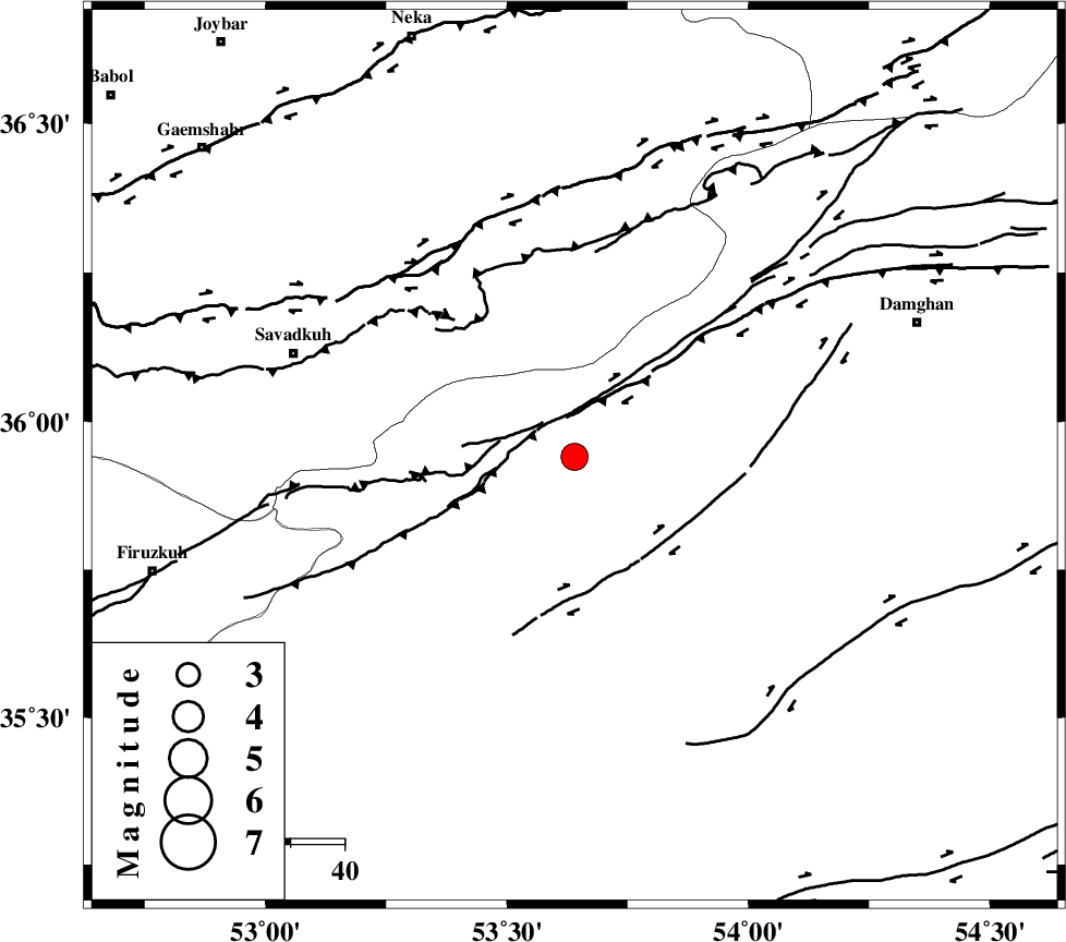
:3.5 |
| Date & Time (UTC) | 2014-02-17 23:34:50.4 |
| Date & Time (Local) | 1392/11/29 03:04:50.4 |
| Location | Lat:35.94 Lon: 53.64 |
| Region | Semnan Province, 47 km North-East of Semnan |
Nearest Cities |
|
| 26 km West of Darvar, Semnan Province | |
| 31 km South of Talma darreh, Mazandaran Province | |
| 34 km South East of Kiasar, Mazandaran Province | |
| 34 km North East of Chashem, Semnan Province | |
| 34 km North East of Shahmirzad, Semnan Province | |
| Depth | 14 km |
| Agency | |
Faults within 150 km: |
|
| ATARI_F (Length: 185 km) , Distance to epicenter: 19 km | |
| DAMGHAN_F (Length: 95 km) , Distance to epicenter: 29 km | |
| ASTANEH_F (Length: 72 km) , Distance to epicenter: 46 km | |
| Number of Phases | 6 |
| RMS | 0.2 |
| Number of Stations | 6 |
| Error in Latitude | >6.3 km |
| Error in Longitude | 2.7 km |
| Error in Depth | 4.9 km |
Download waveform in seisan format
to download seisan software Click here
to access information about IIEES stations Click here
Amplitude | ||||||||
| UID | Agency | Station | Component | Amplitude | Period | Arrival Time | Proccessing Time | Signal Clip |
| 91816 | IIEES | THKV | E | 247.1 | 0.44 | 2014-02-17 23:36:05 | 2014-02-18 12:48:00 | n |
| 91817 | IIEES | GHVR | E | 309.1 | 0.32 | 2014-02-17 23:36:17 | 2014-02-18 12:48:00 | n |
Phase | ||||||||||||
| Agency | Station | Component | Phase Type | Phase Quality | First Motion | Observed Arrival Time | Time Residual | Loc. Flag | Input Weight | Distance | Azimuth | |
| IIEES | SHRO | E | Pg | E | 2014-02-17 23:35:25 | -0.17 | y | 214 | 87 | |||
| IIEES | CHTH | Z | Pg | E | 2014-02-17 23:35:27 | 0.04 | y | 227 | 270 | |||
| IIEES | THKV | Z | Pn | E | 2014-02-17 23:35:28 | -0.28 | y | 249 | 270 | |||
| IIEES | GHVR | Z | Pn | E | 2014-02-17 23:35:31 | 0.06 | y | 272 | 234 | |||
| IIEES | ASAO | Z | Pn | E | 2014-02-17 23:35:43 | 0.18 | y | 363 | 246 | |||
| IIEES | BJRD | Z | Pn | E | 2014-02-17 23:35:46 | 0.25 | y | 389 | 59 | |||