
Magnitude |
:2.8 |
| Date & Time (UTC) | 2014-01-21 03:56:20.9 |
| Date & Time (Local) | 1392/11/1 07:26:20.9 |
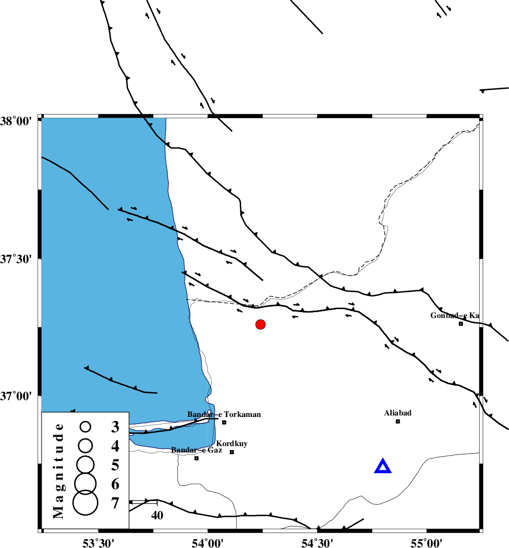
| Location | Lat:37.26 Lon: 54.24 |
| Region | Golestan Province, 33 km North-West of Aq Qaleh |
Nearest Cities |
|
| 23 km North East of Gomishtappeh, Golestan Province | |
| 28 km North of Banavar, Golestan Province | |
| 33 km North West of Aq Qaleh, Golestan Province | |
| 36 km North West of Qanqarmeh, Golestan Province | |
| 43 km North East of Bandar-e torkaman, Golestan Province | |
| Depth | 18 km |
| Agency | |
Faults within 150 km: |
|
| KHAZAR_F (Length: 523 km) , Distance to epicenter: 51 km | |
| N_ALBORZ_F (Length: 360 km) , Distance to epicenter: 73 km | |
| SHAVAR_F (Length: 87 km) , Distance to epicenter: 78 km | |
| Number of Phases | 6 |
| RMS | 0.2 |
| Number of Stations | 4 |
| Error in Latitude | >6.6 km |
| Error in Longitude | 1.7 km |
| Error in Depth | 7.8 km |
Download waveform in seisan format
to download seisan software Click here
to access information about IIEES stations Click here
Amplitude | ||||||||
| UID | Agency | Station | Component | Amplitude | Period | Arrival Time | Proccessing Time | Signal Clip |
| 91560 | IIEES | THKV | E | 28.4 | 0.56 | 2014-01-21 03:58:02 | 2014-01-21 04:43:00 | n |
| 91561 | IIEES | GHVR | E | 13.7 | 0.76 | 2014-01-21 03:58:24 | 2014-01-21 04:43:00 | n |
Phase | ||||||||||||
| Agency | Station | Component | Phase Type | Phase Quality | First Motion | Observed Arrival Time | Time Residual | Loc. Flag | Input Weight | Distance | Azimuth | |
| IIEES | SHRO | E | Pg | E | 2014-01-21 03:56:55 | 0.07 | y | 211 | 131 | |||
| IIEES | SHRO | E | Sg | E | 2014-01-21 03:57:20 | -0.02 | y | 211 | 131 | |||
| IIEES | CHTH | Z | Pn | E | 2014-01-21 03:57:07 | 0.12 | y | 317 | 243 | |||
| IIEES | CHTH | E | Sg | E | 2014-01-21 03:57:50 | 0.24 | y | 317 | 243 | |||
| IIEES | THKV | Z | Pn | E | 2014-01-21 03:57:09 | -0.23 | y | 336 | 245 | |||
| IIEES | GHVR | N | Sg | E | 2014-01-21 03:58:15 | -0.22 | y | 410 | 222 | |||