
Magnitude |
:3.1 |
| Date & Time (UTC) | 2014-01-18 12:01:27.9 |
| Date & Time (Local) | 1392/10/28 15:31:27.9 |
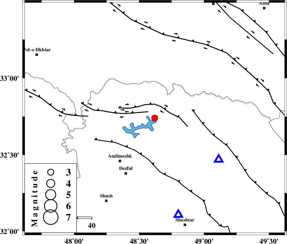
| Location | Lat:32.74 Lon: 48.62 |
| Region | Khoozestan Province, 40 km North-East of Andimeshk |
Nearest Cities |
|
| 19 km West of Shuy, Khoozestan Province | |
| 28 km East of Sorkhakan, Khoozestan Province | |
| 33 km North West of Sardasht, Khoozestan Province | |
| 35 km North East of Hoseinieh, Khoozestan Province | |
| 36 km East of Bidruyeh, Khoozestan Province | |
| Depth | 18 km |
| Agency | |
Faults within 150 km: |
|
| BALARUD_F_Z3 (Length: 53 km) , Distance to epicenter: 7 km | |
| BALARUD_F_Z2 (Length: 58 km) , Distance to epicenter: 9 km | |
| DEZFUL_EMBAYMENT (Length: 228 km) , Distance to epicenter: 27 km | |
| Number of Phases | 5 |
| RMS | 0 |
| Number of Stations | 3 |
| Error in Latitude | >2.8 km |
| Error in Longitude | 7.1 km |
| Error in Depth | 6.2 km |
Download waveform in seisan format
to download seisan software Click here
to access information about IIEES stations Click here
Amplitude | ||||||||
| UID | Agency | Station | Component | Amplitude | Period | Arrival Time | Proccessing Time | Signal Clip |
| 91529 | IIEES | SHGR | E | 1888 | 0.48 | 2014-01-18 12:01:52 | 2014-01-18 12:53:00 | n |
| 91530 | IIEES | SHGR | N | 1791.5 | 0.44 | 2014-01-18 12:01:59 | 2014-01-18 12:53:00 | n |
| 91531 | IIEES | GHVR | E | 38.3 | 0.6 | 2014-01-18 12:02:59 | 2014-01-18 12:53:00 | n |
| 91532 | IIEES | GHVR | N | 43.8 | 0.48 | 2014-01-18 12:03:02 | 2014-01-18 12:53:00 | n |
Phase | ||||||||||||
| Agency | Station | Component | Phase Type | Phase Quality | First Motion | Observed Arrival Time | Time Residual | Loc. Flag | Input Weight | Distance | Azimuth | |
| IIEES | SHGR | Z | Pg | E | 2014-01-18 12:01:40 | -0.03 | y | 71.4 | 166 | |||
| IIEES | SHGR | N | Sg | E | 2014-01-18 12:01:49 | 0.03 | y | 71.4 | 166 | |||
| IIEES | ASAO | Z | Pn | E | 2014-01-18 12:02:05 | 0.06 | y | 239 | 33 | |||
| IIEES | GHVR | Z | Pn | E | 2014-01-18 12:02:13 | -0.07 | y | 311 | 51 | |||
| IIEES | GHVR | E | Sg | E | 2014-01-18 12:02:55 | 0.01 | y | 311 | 51 | |||