
Magnitude |
:2.2 |
| Date & Time (UTC) | 2013-12-23 16:15:01.9 |
| Date & Time (Local) | 1392/10/2 19:45:01.9 |
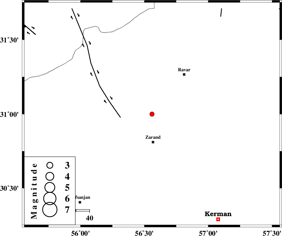
| Location | Lat:31 Lon: 56.56 |
| Region | Kerman Province, 21 km North of Zarand |
Nearest Cities |
|
| 7 km of Ahmadi, Kerman Province | |
| 7 km of Dasht-e khak, Kerman Province | |
| 21 km North of Zarand, Kerman Province | |
| 21 km South East of Toghroljerd, Kerman Province | |
| 24 km North of Mohammadabad, Kerman Province | |
| Depth | 14 km |
| Agency | |
Faults within 150 km: |
|
| KUHBANAN_F (Length: 189 km) , Distance to epicenter: 6 km | |
| DARIVAN_F (Length: 131 km) , Distance to epicenter: 47 km | |
| LAKARKUH_F (Length: 138 km) , Distance to epicenter: 57 km | |
| Number of Phases | 6 |
| RMS | 0.2 |
| Number of Stations | 3 |
| Error in Latitude | >1.7 km |
| Error in Longitude | 2.1 km |
| Error in Depth | 5.8 km |
Download waveform in seisan format
to download seisan software Click here
to access information about IIEES stations Click here
Amplitude | ||||||||
| UID | Agency | Station | Component | Amplitude | Period | Arrival Time | Proccessing Time | Signal Clip |
| 91251 | IIEES | KRBR | E | 54.7 | 0.2 | 2013-12-23 16:15:38 | 2013-12-23 04:39:00 | n |
| 91252 | IIEES | KRBR | N | 58.9 | 0.16 | 2013-12-23 16:15:39 | 2013-12-23 04:39:00 | n |
Phase | ||||||||||||
| Agency | Station | Component | Phase Type | Phase Quality | First Motion | Observed Arrival Time | Time Residual | Loc. Flag | Input Weight | Distance | Azimuth | |
| IIEES | KRBR | Z | Pg | E | 2013-12-23 16:15:21 | -0.3 | y | 115 | 170 | |||
| IIEES | KRBR | E | Sg | E | 2013-12-23 16:15:35 | 0.12 | y | 115 | 170 | |||
| IIEES | YZKH | Z | Pn | E | 2013-12-23 16:15:40 | 0.32 | y | 242 | 310 | |||
| IIEES | YZKH | E | Sg | E | 2013-12-23 16:16:10 | -0.2 | y | 242 | 310 | |||
| IIEES | BSRN | Z | Pn | E | 2013-12-23 16:15:42 | 0.2 | y | 266 | 66 | |||
| IIEES | BSRN | E | Sg | E | 2013-12-23 16:16:16 | -0.13 | y | 266 | 66 | |||