
Magnitude |
:2.4 |
| Date & Time (UTC) | 2013-11-27 15:18:08.6 |
| Date & Time (Local) | 1392/9/6 18:48:08.6 |
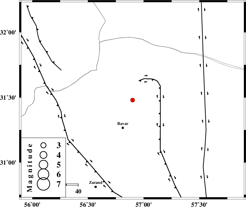
| Location | Lat:31.48 Lon: 56.9 |
| Region | Kerman Province, 25 km North of Ravar |
Nearest Cities |
|
| 20 km North East of Dehali, Kerman Province | |
| 25 km North of Ravar, Kerman Province | |
| 57 km North East of Dasht-e khak, Kerman Province | |
| 58 km North East of Kuhbanan, Kerman Province | |
| 58 km North East of Ahmadi, Kerman Province | |
| Depth | 14 km |
| Agency | |
Faults within 150 km: |
|
| LAKARKUH_F (Length: 138 km) , Distance to epicenter: 17 km | |
| KUHBANAN_F (Length: 189 km) , Distance to epicenter: 62 km | |
| JAFARABAD_F (Length: 60 km) , Distance to epicenter: 66 km | |
| Number of Phases | 6 |
| RMS | 0.1 |
| Number of Stations | 4 |
| Error in Latitude | >1 km |
| Error in Longitude | 1.4 km |
| Error in Depth | 2.9 km |
Download waveform in seisan format
to download seisan software Click here
to access information about IIEES stations Click here
Amplitude | ||||||||
| UID | Agency | Station | Component | Amplitude | Period | Arrival Time | Proccessing Time | Signal Clip |
| 91085 | IIEES | KRBR | N | 46.1 | 0.16 | 2013-11-27 15:19:00 | 2013-11-27 03:48:00 | n |
Phase | ||||||||||||
| Agency | Station | Component | Phase Type | Phase Quality | First Motion | Observed Arrival Time | Time Residual | Loc. Flag | Input Weight | Distance | Azimuth | |
| IIEES | KRBR | Z | Pg | E | 2013-11-27 15:18:36 | 0.01 | y | 166 | 184 | |||
| IIEES | BSRN | Z | Pn | E | 2013-11-27 15:18:43 | 0.02 | y | 218 | 75 | |||
| IIEES | BSRN | N | Sg | E | 2013-11-27 15:19:10 | -0.04 | y | 218 | 75 | |||
| IIEES | YZKH | Z | Pn | E | 2013-11-27 15:18:46 | -0.09 | y | 240 | 295 | |||
| IIEES | TABS | Z | Pn | E | 2013-11-27 15:18:46 | 0.11 | y | 242 | 5 | |||
| IIEES | TABS | E | Sg | E | 2013-11-27 15:19:16 | -0.02 | y | 242 | 5 | |||