
Magnitude |
:2.8 |
| Date & Time (UTC) | 2013-10-28 23:00:58.3 |
| Date & Time (Local) | 1392/8/7 02:30:58.3 |
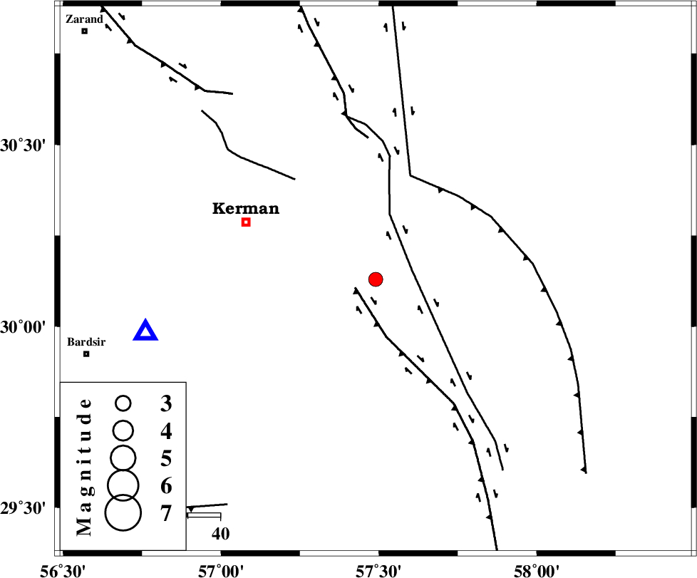
| Location | Lat:30.13 Lon: 57.49 |
| Region | Kerman Province, 43 km South-East of Kerman |
Nearest Cities |
|
| 10 km of Sirch, Kerman Province | |
| 13 km North West of Jushan, Kerman Province | |
| 21 km North East of Mahan, Kerman Province | |
| 22 km North East of Langar, Kerman Province | |
| 26 km North East of Mohiabad, Kerman Province | |
| Depth | 14 km |
| Agency | |
Faults within 150 km: |
|
| GOWK_F (Length: 152 km) , Distance to epicenter: 7 km | |
| GOLBAF_SIRCH_F (Length: 114 km) , Distance to epicenter: 11 km | |
| NAYBAND_F (Length: 258 km) , Distance to epicenter: 33 km | |
| Number of Phases | 4 |
| RMS | 0.1 |
| Number of Stations | 3 |
| Error in Latitude | >4.2 km |
| Error in Longitude | 4.2 km |
| Error in Depth | 7 km |
Download waveform in seisan format
to download seisan software Click here
to access information about IIEES stations Click here
Amplitude | ||||||||
| UID | Agency | Station | Component | Amplitude | Period | Arrival Time | Proccessing Time | Signal Clip |
| 90878 | IIEES | KRBR | E | 512.8 | 0.16 | 2013-10-28 23:01:26 | 2013-10-29 12:52:00 | n |
Phase | ||||||||||||
| Agency | Station | Component | Phase Type | Phase Quality | First Motion | Observed Arrival Time | Time Residual | Loc. Flag | Input Weight | Distance | Azimuth | |
| IIEES | KRBR | Z | Pg | E | 2013-10-28 23:01:11 | -0.05 | y | 72.7 | 257 | |||
| IIEES | BSRN | Z | Pn | E | 2013-10-28 23:01:38 | 0.22 | y | 256 | 37 | |||
| IIEES | BSRN | N | Sg | E | 2013-10-28 23:02:10 | -0.11 | y | 256 | 37 | |||
| IIEES | ZHSF | Z | Pn | E | 2013-10-28 23:01:46 | -0.06 | y | 322 | 100 | |||