
Magnitude |
:3.5 |
| Date & Time (UTC) | 2013-05-19 05:41:18.3 |
| Date & Time (Local) | 1392/2/29 10:11:18.3 |
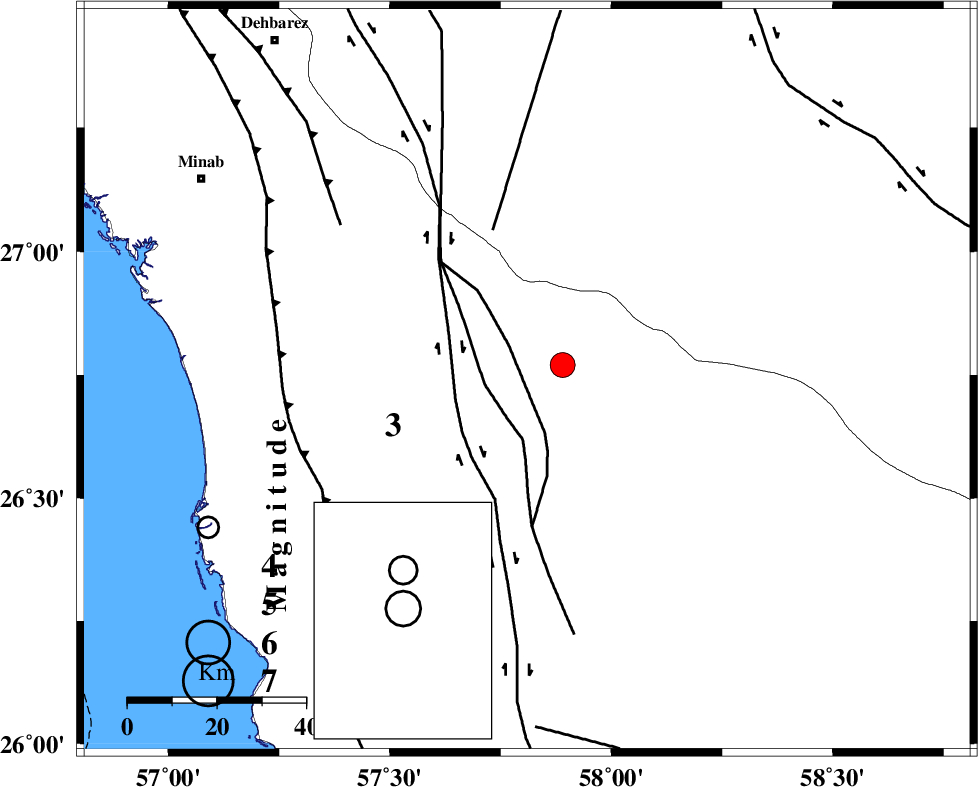
| Location | Lat:26.74 Lon: 57.81 |
| Region | Hormozgan Province, 80 km South-East of Manujan |
Nearest Cities |
|
| 18 km North of Angahran, Hormozgan Province | |
| 26 km North East of Darpahn, Hormozgan Province | |
| 39 km East of Sanadrak, Hormozgan Province | |
| 42 km South West of Keshmiran, Kerman Province | |
| 64 km South East of Koryan, Hormozgan Province | |
| Depth | 15 km |
| Agency | |
Faults within 150 km: |
|
| SABZEVARAN_F (Length: 190 km) , Distance to epicenter: 44 km | |
| ZENDAN_MINAB_F_Z2 (Length: 63 km) , Distance to epicenter: 44 km | |
| ZENDAN_MINAB_F_Z1 (Length: 183 km) , Distance to epicenter: 52 km | |
| Number of Phases | 6 |
| RMS | 0.4 |
| Number of Stations | 7 |
| Error in Latitude | >5.2 km |
| Error in Longitude | 2.7 km |
| Error in Depth | 0 km |
Download waveform in seisan format
to download seisan software Click here
to access information about IIEES stations Click here
Amplitude | ||||||||
| UID | Agency | Station | Component | Amplitude | Period | Arrival Time | Proccessing Time | Signal Clip |
| 89350 | IIEES | BNDS | N | 513 | 0.59 | 2013-05-19 05:42:07 | 2013-05-19 07:15:00 | n |
Phase | ||||||||||||
| Agency | Station | Component | Phase Type | Phase Quality | First Motion | Observed Arrival Time | Time Residual | Loc. Flag | Input Weight | Distance | Azimuth | |
| IIEES | CHBR | Z | Pn | E | 2013-05-19 05:42:02 | 0 | y | 296 | 115 | |||
| IIEES | KRBR | Z | Pn | E | 2013-05-19 05:42:12 | 0.33 | y | 373 | 344 | |||
| IIEES | ZHSF | Z | Pn | E | 2013-05-19 05:42:19 | 0.19 | y | 431 | 42 | |||
| IIEES | GHIR | Z | Pn | E | 2013-05-19 05:42:28 | -0.08 | y | 506 | 291 | |||
| IIEES | BSRN | Z | Pn | E | 2013-05-19 05:42:38 | -0.81 | y | 593 | 12 | |||
| IIEES | SHRT | Z | Pn | E | 2013-05-19 05:43:05 | 0.28 | y | 802 | 17 | |||