
Magnitude |
:3.8 |
| Date & Time (UTC) | 2013-05-11 13:20:41.3 |
| Date & Time (Local) | 1392/2/21 17:50:41.3 |
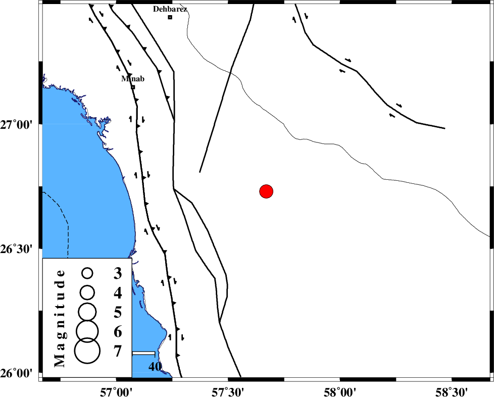
| Location | Lat:26.73 Lon: 57.67 |
| Region | Hormozgan Province, 77 km South-East of Manujan |
Nearest Cities |
|
| 14 km North East of Darpahn, Hormozgan Province | |
| 27 km South East of Sanadrak, Hormozgan Province | |
| 27 km North West of Angahran, Hormozgan Province | |
| 49 km South West of Keshmiran, Kerman Province | |
| 51 km South East of Koryan, Hormozgan Province | |
| Depth | 15 km |
| Agency | |
Faults within 150 km: |
|
| SABZEVARAN_F (Length: 190 km) , Distance to epicenter: 31 km | |
| ZENDAN_MINAB_F_Z2 (Length: 63 km) , Distance to epicenter: 31 km | |
| ZENDAN_MINAB_F_Z1 (Length: 183 km) , Distance to epicenter: 38 km | |
| Number of Phases | 4 |
| RMS | 0.1 |
| Number of Stations | 5 |
| Error in Latitude | >3.2 km |
| Error in Longitude | 1.6 km |
| Error in Depth | 0 km |
Download waveform in seisan format
to download seisan software Click here
to access information about IIEES stations Click here
Amplitude | ||||||||
| UID | Agency | Station | Component | Amplitude | Period | Arrival Time | Proccessing Time | Signal Clip |
| 89183 | IIEES | AHRM | N | 38.4 | 0.4 | 2013-05-11 13:23:25 | 2013-05-11 02:49:00 | n |
| 89184 | IIEES | AHRM | E | 26 | 0.4 | 2013-05-11 13:23:29 | 2013-05-11 02:49:00 | n |
Phase | ||||||||||||
| Agency | Station | Component | Phase Type | Phase Quality | First Motion | Observed Arrival Time | Time Residual | Loc. Flag | Input Weight | Distance | Azimuth | |
| IIEES | CHBR | Z | Pn | E | 2013-05-11 13:21:27 | 0.04 | y | 308 | 113 | |||
| IIEES | ZHSF | Z | P | E | 2013-05-11 13:21:43 | -0.17 | y | 442 | 43 | |||
| IIEES | GHIR | Z | Pn | E | 2013-05-11 13:21:50 | -0.04 | y | 493 | 292 | |||
| IIEES | BSRN | Z | P | E | 2013-05-11 13:22:03 | 0.21 | y | 597 | 13 | |||