
Magnitude |
:4.1 |
| Date & Time (UTC) | 2013-05-11 05:59:37.1 |
| Date & Time (Local) | 1392/2/21 10:29:37.1 |
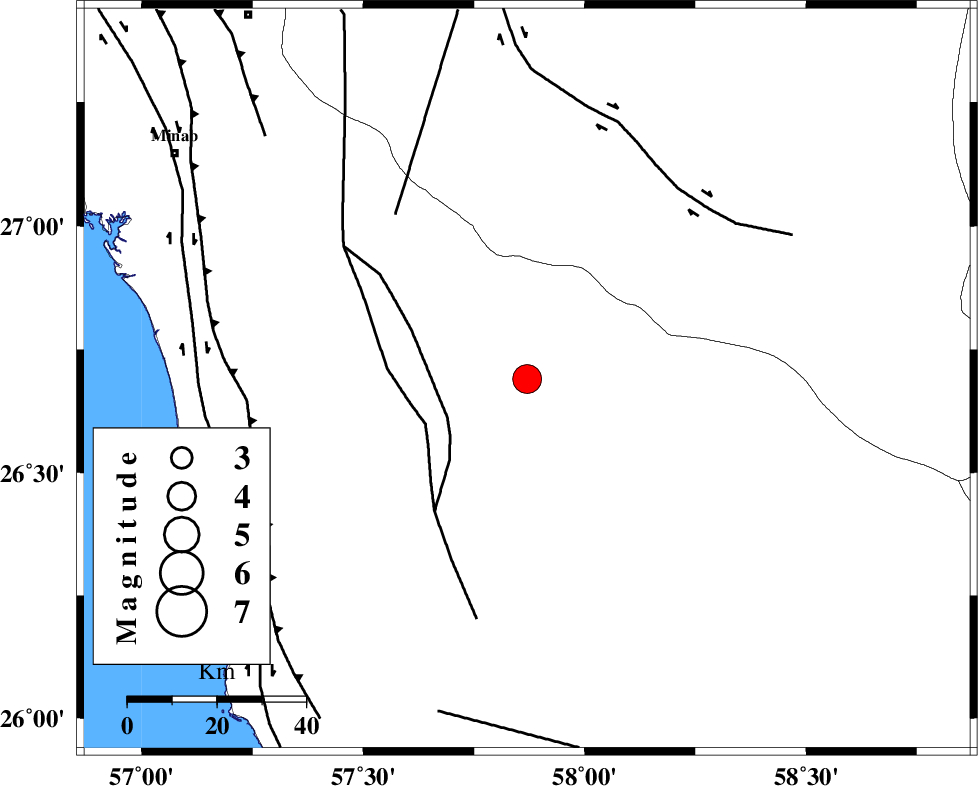
| Location | Lat:26.69 Lon: 57.87 |
| Region | Hormozgan Province, 89 km South-East of Manujan |
Nearest Cities |
|
| 11 km North of Angahran, Hormozgan Province | |
| 30 km North East of Darpahn, Hormozgan Province | |
| 47 km South East of Sanadrak, Hormozgan Province | |
| 47 km South of Keshmiran, Kerman Province | |
| 71 km South East of Koryan, Hormozgan Province | |
| Depth | 15 km |
| Agency | |
Faults within 150 km: |
|
| ZENDAN_MINAB_F_Z2 (Length: 63 km) , Distance to epicenter: 48 km | |
| SABZEVARAN_F (Length: 190 km) , Distance to epicenter: 51 km | |
| JIROFT_F (Length: 144 km) , Distance to epicenter: 55 km | |
| Number of Phases | 6 |
| RMS | 0.4 |
| Number of Stations | 7 |
| Error in Latitude | >6.1 km |
| Error in Longitude | 2.6 km |
| Error in Depth | 0 km |
Download waveform in seisan format
to download seisan software Click here
to access information about IIEES stations Click here
Amplitude | ||||||||
| UID | Agency | Station | Component | Amplitude | Period | Arrival Time | Proccessing Time | Signal Clip |
| 89174 | IIEES | BNDS | E | 1865.8 | 0.46 | 2013-05-11 06:00:40 | 2013-05-11 10:28:00 | n |
| 89175 | IIEES | BNDS | N | 1863.8 | 0.77 | 2013-05-11 06:00:44 | 2013-05-11 10:28:00 | n |
Phase | ||||||||||||
| Agency | Station | Component | Phase Type | Phase Quality | First Motion | Observed Arrival Time | Time Residual | Loc. Flag | Input Weight | Distance | Azimuth | |
| IIEES | CHBR | Z | Pn | E | 2013-05-11 06:00:20 | -0.12 | y | 288 | 114 | |||
| IIEES | ZHSF | Z | Pn | E | 2013-05-11 06:00:38 | 0.33 | y | 432 | 41 | |||
| IIEES | GHIR | Z | P | E | 2013-05-11 06:00:48 | -0.2 | y | 514 | 291 | |||
| IIEES | BSRN | Z | P | E | 2013-05-11 06:00:59 | -0.04 | y | 598 | 12 | |||
| IIEES | AHRM | Z | P | E | 2013-05-11 06:01:11 | 0.75 | y | 691 | 292 | |||
| IIEES | YZKH | Z | P | E | 2013-05-11 06:01:12 | -0.74 | y | 707 | 334 | |||