
Magnitude |
:3.7 |
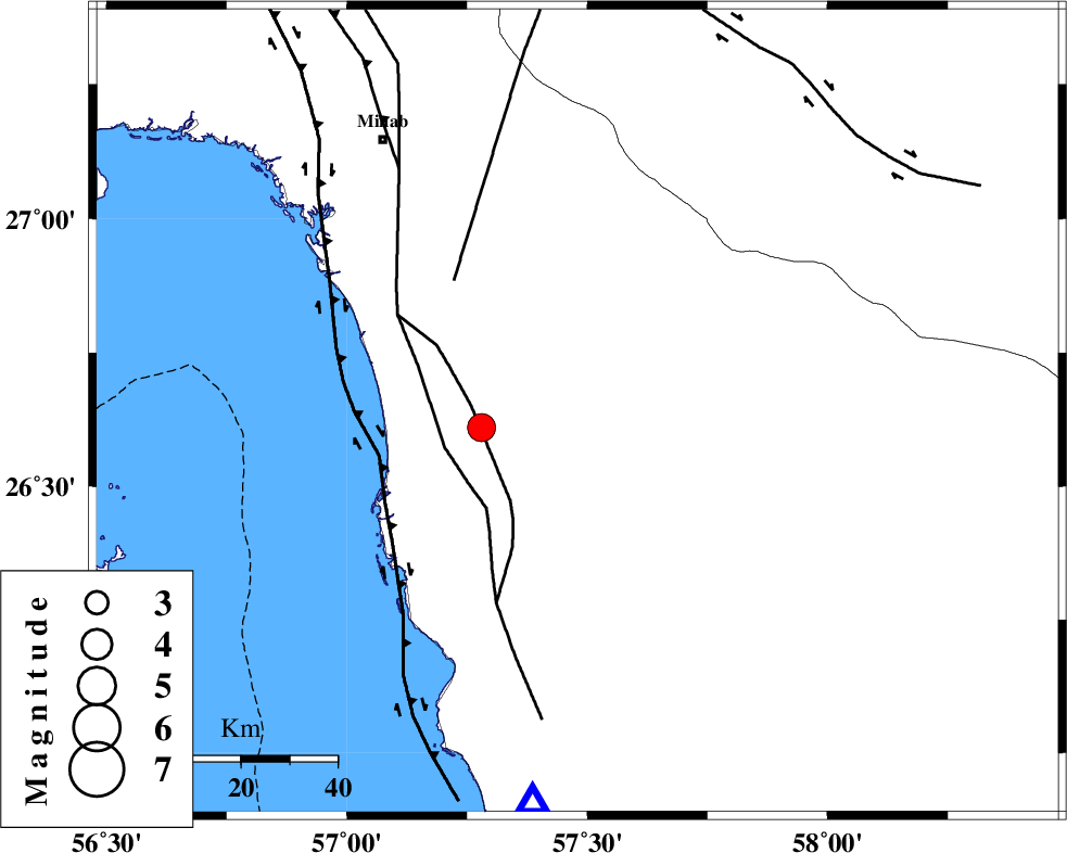
| Date & Time (UTC) | 2013-05-11 02:45:46.9 |
| Date & Time (Local) | 1392/2/21 07:15:46.9 |
| Location | Lat:26.64 Lon: 57.48 |
| Region | Hormozgan Province, 86 km South of Manujan |
Nearest Cities |
|
| 9 km of Darpahn, Hormozgan Province | |
| 22 km South of Sanadrak, Hormozgan Province | |
| 40 km North East of Gonmardi, Hormozgan Province | |
| 40 km North East of Bandar-e sirk, Hormozgan Province | |
| 42 km North West of Angahran, Hormozgan Province | |
| Depth | 15 km |
| Agency | |
Faults within 150 km: |
|
| ZENDAN_MINAB_F_Z2 (Length: 63 km) , Distance to epicenter: 10 km | |
| ZENDAN_MINAB_F_Z1 (Length: 183 km) , Distance to epicenter: 18 km | |
| SABZEVARAN_F (Length: 190 km) , Distance to epicenter: 21 km | |
| Number of Phases | 4 |
| RMS | 0.2 |
| Number of Stations | 5 |
| Error in Latitude | >5 km |
| Error in Longitude | 1.8 km |
| Error in Depth | 0 km |
Download waveform in seisan format
to download seisan software Click here
to access information about IIEES stations Click here
Amplitude | ||||||||
| UID | Agency | Station | Component | Amplitude | Period | Arrival Time | Proccessing Time | Signal Clip |
| 89160 | IIEES | BNDS | N | 1258.4 | 0.45 | 2013-05-11 02:46:36 | 2013-05-11 09:00:00 | n |
| 89161 | IIEES | BNDS | E | 902.2 | 0.48 | 2013-05-11 02:46:39 | 2013-05-11 09:00:00 | n |
Phase | ||||||||||||
| Agency | Station | Component | Phase Type | Phase Quality | First Motion | Observed Arrival Time | Time Residual | Loc. Flag | Input Weight | Distance | Azimuth | |
| IIEES | CHBR | Z | Pn | E | 2013-05-11 02:46:34 | 0.08 | y | 322 | 110 | |||
| IIEES | ZHSF | Z | Pn | E | 2013-05-11 02:46:51 | -0.2 | y | 462 | 44 | |||
| IIEES | GHIR | Z | P | E | 2013-05-11 02:46:54 | -0.17 | y | 480 | 293 | |||
| IIEES | YZKH | Z | P | E | 2013-05-11 02:47:21 | 0.42 | y | 696 | 337 | |||