
Magnitude |
:3.4 |
| Date & Time (UTC) | 2013-04-16 07:09:23.4 |
| Date & Time (Local) | 1392/1/27 11:39:23.4 |
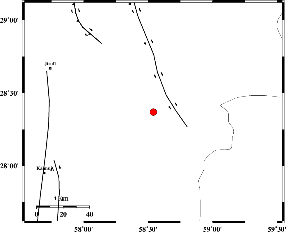
| Location | Lat:28.37 Lon: 58.54 |
| Region | Kerman Province, 84 km South-East of Bam |
Nearest Cities |
|
| 36 km North East of Mardehak, Kerman Province | |
| 38 km North of Borj-e abbasabad, Kerman Province | |
| 50 km South West of Mohammadabad-e gonbaki, Kerman Province | |
| 53 km South of Kruk, Kerman Province | |
| 53 km South East of Dahane-ye gomrokan, Kerman Province | |
| Depth | 14 km |
| Agency | |
Faults within 150 km: |
|
| BAM_F (Length: 118 km) , Distance to epicenter: 16 km | |
| GOWK_F (Length: 152 km) , Distance to epicenter: 65 km | |
| SABZEVARAN_F (Length: 190 km) , Distance to epicenter: 79 km | |
| Number of Phases | 6 |
| RMS | 0.1 |
| Number of Stations | 5 |
| Error in Latitude | >2.3 km |
| Error in Longitude | 3.8 km |
| Error in Depth | 6.4 km |
Download waveform in seisan format
to download seisan software Click here
to access information about IIEES stations Click here
Amplitude | ||||||||
| UID | Agency | Station | Component | Amplitude | Period | Arrival Time | Proccessing Time | Signal Clip |
| 88745 | IIEES | CHBR | E | 92.9 | 0.53 | 2013-04-16 07:10:58 | 2013-04-16 09:05:00 | n |
| 88746 | IIEES | TABS | N | 21.6 | 0.73 | 2013-04-16 07:12:26 | 2013-04-16 09:05:00 | n |
| 88747 | IIEES | TABS | E | 16 | 0.54 | 2013-04-16 07:12:28 | 2013-04-16 09:05:00 | n |
Phase | ||||||||||||
| Agency | Station | Component | Phase Type | Phase Quality | First Motion | Observed Arrival Time | Time Residual | Loc. Flag | Input Weight | Distance | Azimuth | |
| IIEES | KRBR | Z | Pg | E | 2013-04-16 07:10:04 | 0.08 | y | 248 | 316 | |||
| IIEES | ZHSF | Z | Pn | E | 2013-04-16 07:10:03 | 0.21 | y | 258 | 57 | |||
| IIEES | CHBR | Z | Pn | E | 2013-04-16 07:10:16 | -0.13 | y | 363 | 147 | |||
| IIEES | BSRN | Z | Pn | E | 2013-04-16 07:10:20 | -0.17 | y | 402 | 8 | |||
| IIEES | BSRN | E | Sg | E | 2013-04-16 07:11:15 | -0.1 | y | 402 | 8 | |||
| IIEES | TABS | Z | Pn | E | 2013-04-16 07:10:45 | 0.07 | y | 600 | 347 | |||