
Magnitude |
:3.1 |
| Date & Time (UTC) | 2013-03-19 17:39:53.5 |
| Date & Time (Local) | 1391/12/29 21:09:53.5 |
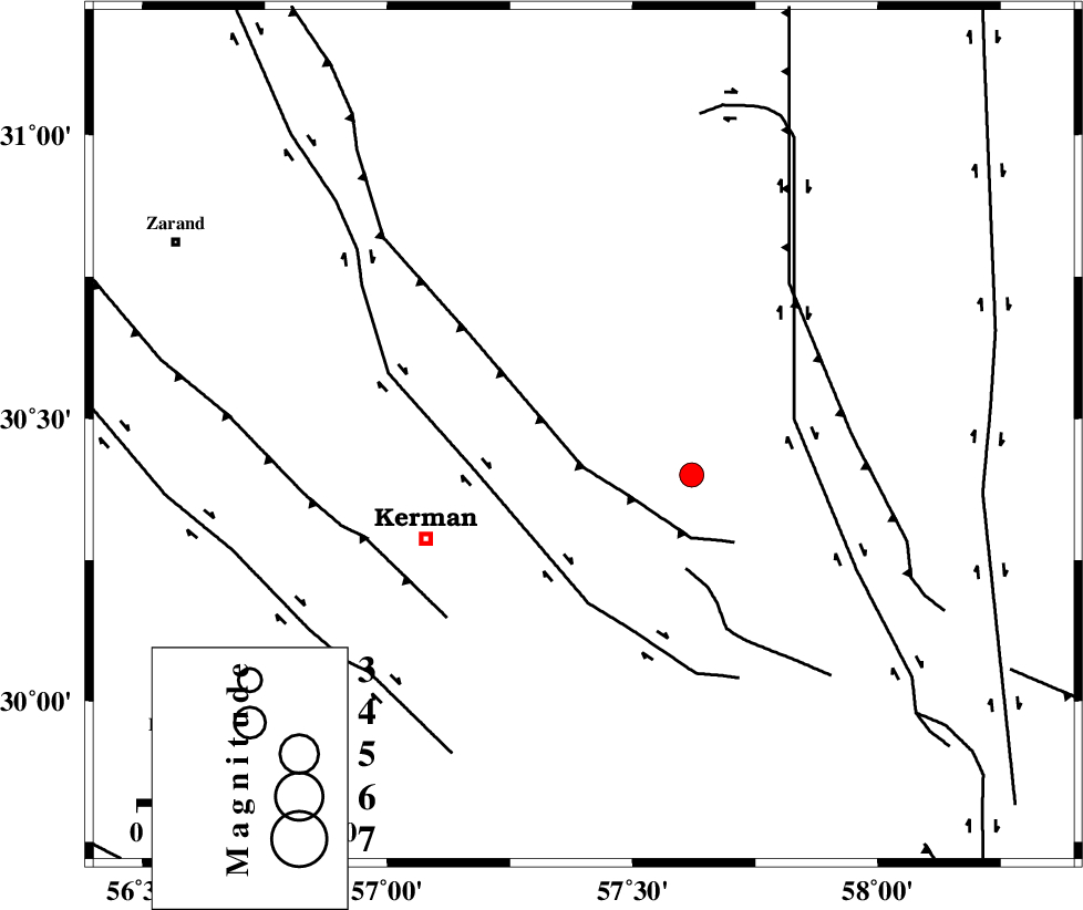
| Location | Lat:30.47 Lon: 57.4 |
| Region | Kerman Province, 37 km North-East of Kerman |
Nearest Cities |
|
| 13 km East of Dehlulu, Kerman Province | |
| 30 km North West of Shahdad, Kerman Province | |
| 33 km North East of Sarasiyab-e ferangi, Kerman Province | |
| 33 km South East of Harjand, Kerman Province | |
| 34 km North West of Sirch, Kerman Province | |
| Depth | 18 km |
| Agency | |
Faults within 150 km: |
|
| LAKARKUH_F (Length: 138 km) , Distance to epicenter: 8 km | |
| GOLBAF_SIRCH_F (Length: 114 km) , Distance to epicenter: 11 km | |
| CHATRUD_F (Length: 37 km) , Distance to epicenter: 17 km | |
| Number of Phases | 6 |
| RMS | 0.1 |
| Number of Stations | 5 |
| Error in Latitude | >3.2 km |
| Error in Longitude | 4.4 km |
| Error in Depth | 11.8 km |
Download waveform in seisan format
to download seisan software Click here
to access information about IIEES stations Click here
Amplitude | ||||||||
| UID | Agency | Station | Component | Amplitude | Period | Arrival Time | Proccessing Time | Signal Clip |
| 88261 | IIEES | KRBR | E | 757.8 | 0.24 | 2013-03-19 17:40:26 | 2013-03-19 06:04:00 | n |
Phase | ||||||||||||
| Agency | Station | Component | Phase Type | Phase Quality | First Motion | Observed Arrival Time | Time Residual | Loc. Flag | Input Weight | Distance | Azimuth | |
| IIEES | KRBR | Z | Pg | E | 2013-03-19 17:40:07 | -0.07 | y | 81.7 | 229 | |||
| IIEES | KRBR | N | Sg | E | 2013-03-19 17:40:18 | 0.06 | y | 81.7 | 229 | |||
| IIEES | BSRN | Z | Pn | E | 2013-03-19 17:40:30 | 0.11 | y | 234 | 44 | |||
| IIEES | ZHSF | Z | Pn | E | 2013-03-19 17:40:42 | -0.06 | y | 339 | 105 | |||
| IIEES | TABS | Z | Pn | E | 2013-03-19 17:40:44 | -0.08 | y | 354 | 356 | |||
| IIEES | SHRT | Z | Pn | E | 2013-03-19 17:40:56 | 0.02 | y | 446 | 37 | |||