
Magnitude |
:3.3 |
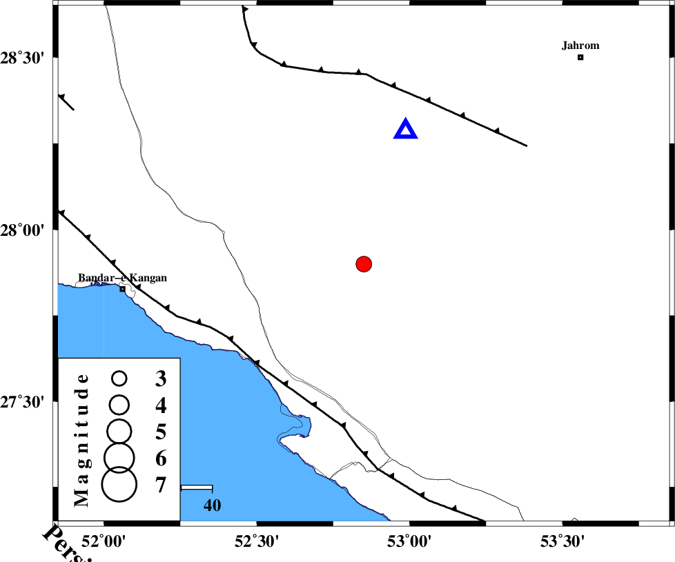
| Date & Time (UTC) | 2013-02-22 09:59:23.9 |
| Date & Time (Local) | 1391/12/4 13:29:23.9 |
| Location | Lat:27.9 Lon: 52.85 |
| Region | Fars Province, 39 km North of Mehr |
Nearest Cities |
|
| 17 km South East of Garmesht, Fars Province | |
| 26 km North East of Asir, Fars Province | |
| 32 km North East of Gallehdar, Fars Province | |
| 33 km North West of Alamarvdasht, Fars Province | |
| 35 km North of Ardavan-e olia, Fars Province | |
| Depth | 25 km |
| Agency | |
Faults within 150 km: |
|
| MFF3 (Length: 292 km) , Distance to epicenter: 47 km | |
| QIR_F (Length: 130 km) , Distance to epicenter: 56 km | |
| SABZ_PUSHAN_F_Z1 (Length: 69 km) , Distance to epicenter: 91 km | |
| Number of Phases | 5 |
| RMS | 0 |
| Number of Stations | 4 |
| Error in Latitude | >8.1 km |
| Error in Longitude | 1.7 km |
| Error in Depth | 4 km |
Download waveform in seisan format
to download seisan software Click here
to access information about IIEES stations Click here
Amplitude | ||||||||
| UID | Agency | Station | Component | Amplitude | Period | Arrival Time | Proccessing Time | Signal Clip |
| 87999 | IIEES | AHRM | N | 414.2 | 0.44 | 2013-02-22 10:00:22 | 2013-02-22 10:33:00 | n |
| 88000 | IIEES | AHRM | E | 316.6 | 0.48 | 2013-02-22 10:00:24 | 2013-02-22 10:33:00 | n |
Phase | ||||||||||||
| Agency | Station | Component | Phase Type | Phase Quality | First Motion | Observed Arrival Time | Time Residual | Loc. Flag | Input Weight | Distance | Azimuth | |
| IIEES | GHIR | Z | Pg | E | 2013-02-22 09:59:32 | -0.01 | y | 45.4 | 18 | |||
| IIEES | AHRM | Z | Pn | E | 2013-02-22 09:59:53 | -0.02 | y | 186 | 306 | |||
| IIEES | AHRM | N | Sg | E | 2013-02-22 10:00:15 | 0.02 | y | 186 | 306 | |||
| IIEES | KRBR | Z | Pn | E | 2013-02-22 10:00:26 | 0.03 | y | 446 | 58 | |||
| IIEES | YZKH | Z | Pn | E | 2013-02-22 10:00:36 | -0.02 | y | 526 | 18 | |||