
Magnitude |
:3.4 |
| Date & Time (UTC) | 2013-02-11 01:19:37.8 |
| Date & Time (Local) | 1391/11/23 04:49:37.8 |
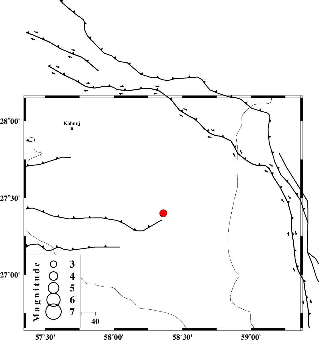
| Location | Lat:27.4 Lon: 58.36 |
| Region | Kerman Province, 85 km East of Manujan |
Nearest Cities |
|
| 49 km South East of Qalehy-eganj, Kerman Province | |
| 55 km North East of Keshmiran, Kerman Province | |
| 71 km South West of Borj-e abbasabad, Kerman Province | |
| 74 km South East of Bargah, Kerman Province | |
| 76 km North West of Ramashk, Kerman Province | |
| Depth | 33 km |
| Agency | |
Faults within 150 km: |
|
| JIROFT_F (Length: 144 km) , Distance to epicenter: 35 km | |
| SABZEVARAN_F (Length: 190 km) , Distance to epicenter: 74 km | |
| S_JAZMURIAN_F (Length: 91 km) , Distance to epicenter: 88 km | |
| Number of Phases | 6 |
| RMS | 0.1 |
| Number of Stations | 5 |
| Error in Latitude | >2.4 km |
| Error in Longitude | 3.4 km |
| Error in Depth | 4.5 km |
Download waveform in seisan format
to download seisan software Click here
to access information about IIEES stations Click here
Amplitude | ||||||||
| UID | Agency | Station | Component | Amplitude | Period | Arrival Time | Proccessing Time | Signal Clip |
| 87852 | IIEES | KRBR | N | 127.2 | 0.36 | 2013-02-11 01:21:01 | 2013-02-11 02:57:00 | n |
| 87853 | IIEES | KRBR | E | 120.6 | 0.48 | 2013-02-11 01:21:02 | 2013-02-11 02:57:00 | n |
| 87854 | IIEES | GHIR | E | 24.9 | 0.32 | 2013-02-11 01:21:39 | 2013-02-11 02:57:00 | n |
| 87855 | IIEES | GHIR | N | 28.6 | 0.28 | 2013-02-11 01:21:40 | 2013-02-11 02:57:00 | n |
Phase | ||||||||||||
| Agency | Station | Component | Phase Type | Phase Quality | First Motion | Observed Arrival Time | Time Residual | Loc. Flag | Input Weight | Distance | Azimuth | |
| IIEES | CHBR | Z | Pn | E | 2013-02-11 01:20:19 | 0.06 | y | 291 | 133 | |||
| IIEES | CHBR | N | Sn | 2013-02-11 01:20:50 | -0.03 | y | 291 | 133 | ||||
| IIEES | KRBR | Z | Pn | E | 2013-02-11 01:20:24 | 0.02 | y | 326 | 332 | |||
| IIEES | KRBR | N | Sn | 2013-02-11 01:20:58 | 0.03 | y | 326 | 332 | ||||
| IIEES | ZHSF | Z | Pn | E | 2013-02-11 01:20:26 | -0.01 | y | 341 | 43 | |||
| IIEES | YZKH | Z | Pn | E | 2013-02-11 01:21:06 | -0.14 | y | 662 | 328 | |||