
Magnitude |
:3.2 |
| Date & Time (UTC) | 2013-02-09 19:23:50.7 |
| Date & Time (Local) | 1391/11/21 22:53:50.7 |
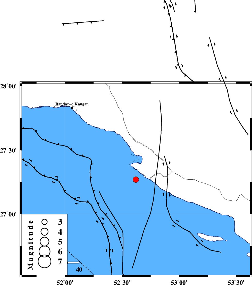
| Location | Lat:27.27 Lon: 52.62 |
| Region | Persian Gulf, 41 km South-West of Mehr |
Nearest Cities |
|
| 19 km West of Chah-e mobarak, Bushehr Province | |
| 23 km South of Bandar-e asaluyeh, Bushehr Province | |
| 40 km South West of Ardavan-e olia, Fars Province | |
| 40 km South West of Khoozi, Fars Province | |
| 41 km South West of Mehr, Fars Province | |
| Depth | 14 km |
| Agency | |
Faults within 150 km: |
|
| MFF3 (Length: 292 km) , Distance to epicenter: 23 km | |
| ZFF1 (Length: 165 km) , Distance to epicenter: 127 km | |
| BORAZJAN_F (Length: 168 km) , Distance to epicenter: 129 km | |
| Number of Phases | 4 |
| RMS | 0.1 |
| Number of Stations | 3 |
| Error in Latitude | >21.9 km |
| Error in Longitude | 7.1 km |
| Error in Depth | 18.6 km |
Download waveform in seisan format
to download seisan software Click here
to access information about IIEES stations Click here
Amplitude | ||||||||
| UID | Agency | Station | Component | Amplitude | Period | Arrival Time | Proccessing Time | Signal Clip |
| 87841 | IIEES | GHIR | N | 1001.6 | 0.4 | 2013-02-09 19:24:29 | 2013-02-09 07:49:00 | n |
| 87842 | IIEES | GHIR | E | 926.2 | 0.48 | 2013-02-09 19:24:29 | 2013-02-09 07:49:00 | n |
| 87843 | IIEES | AHRM | N | 72.1 | 0.48 | 2013-02-09 19:25:00 | 2013-02-09 07:49:00 | n |
Phase | ||||||||||||
| Agency | Station | Component | Phase Type | Phase Quality | First Motion | Observed Arrival Time | Time Residual | Loc. Flag | Input Weight | Distance | Azimuth | |
| IIEES | GHIR | Z | Pg | E | 2013-02-09 19:24:10 | -0.07 | y | 118 | 18 | |||
| IIEES | AHRM | Z | Pn | E | 2013-02-09 19:24:25 | -0.05 | y | 220 | 324 | |||
| IIEES | AHRM | N | Sg | E | 2013-02-09 19:24:52 | 0.05 | y | 220 | 324 | |||
| IIEES | KRBR | Z | Pn | E | 2013-02-09 19:25:01 | 0.12 | y | 504 | 52 | |||