
Magnitude |
:2.5 |
| Date & Time (UTC) | 2013-01-07 18:49:02.8 |
| Date & Time (Local) | 1391/10/18 22:19:02.8 |
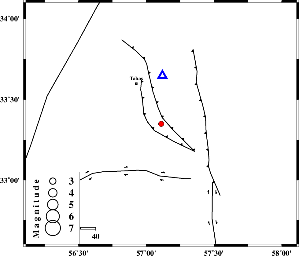
| Location | Lat:33.35 Lon: 57.11 |
| Region | Yazd Province, 32 km South-East of Tabas |
Nearest Cities |
|
| 20 km South East of Kerit, Yazd Province | |
| 29 km South East of Oshtoqran, Yazd Province | |
| 33 km South East of Tabas, Yazd Province | |
| 36 km North West of Dihuk, Yazd Province | |
| 46 km South West of Arsak, Khorasan(center) Province | |
| Depth | 14 km |
| Agency | |
Faults within 150 km: |
|
| TABAS_F1 (Length: 91 km) , Distance to epicenter: 4 km | |
| TABAS_F2 (Length: 67 km) , Distance to epicenter: 7 km | |
| ESFARDIAR_F (Length: 94 km) , Distance to epicenter: 31 km | |
| Number of Phases | 6 |
| RMS | 0.4 |
| Number of Stations | 4 |
| Error in Latitude | >5.5 km |
| Error in Longitude | 3.6 km |
| Error in Depth | 8.6 km |
Download waveform in seisan format
to download seisan software Click here
to access information about IIEES stations Click here
Amplitude | ||||||||
| UID | Agency | Station | Component | Amplitude | Period | Arrival Time | Proccessing Time | Signal Clip |
| 87549 | IIEES | YZKH | N | 25.2 | 0.44 | 2013-01-07 18:50:19 | 2013-01-07 07:48:00 | n |
Phase | ||||||||||||
| Agency | Station | Component | Phase Type | Phase Quality | First Motion | Observed Arrival Time | Time Residual | Loc. Flag | Input Weight | Distance | Azimuth | |
| IIEES | TABS | Z | Pg | E | 2013-01-07 18:49:08 | -0.36 | y | 32.7 | 2 | |||
| IIEES | YZKH | Z | Pn | E | 2013-01-07 18:49:42 | 0.02 | y | 259 | 246 | |||
| IIEES | YZKH | N | Sg | E | 2013-01-07 18:50:15 | -0.23 | y | 259 | 246 | |||
| IIEES | SHRT | Z | Pn | E | 2013-01-07 18:49:48 | 0.74 | y | 297 | 83 | |||
| IIEES | SHRT | N | Sg | E | 2013-01-07 18:50:25 | -0.49 | y | 297 | 83 | |||
| IIEES | SHRO | Z | Pn | E | 2013-01-07 18:49:49 | 0.36 | y | 311 | 341 | |||