
Magnitude |
:3.6 |
| Date & Time (UTC) | 2012-12-22 20:23:31.7 |
| Date & Time (Local) | 1391/10/2 23:53:31.7 |
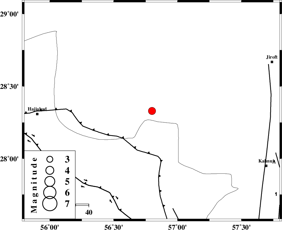
| Location | Lat:28.33 Lon: 56.8 |
| Region | Kerman Province, 88 km East of Hajiabad |
Nearest Cities |
|
| 8 km of Sarkhan, Kerman Province | |
| 43 km South East of Shahmaran, Kerman Province | |
| 45 km South East of Arzuieeh, Kerman Province | |
| 51 km South West of Dolatabad, Kerman Province | |
| 53 km North West of Hurpasefid, Kerman Province | |
| Depth | 18 km |
| Agency | |
Faults within 150 km: |
|
| MAIN_ZAGROS_R_F (Length: 1106 km) , Distance to epicenter: 31 km | |
| HZF2 (Length: 437 km) , Distance to epicenter: 71 km | |
| ZENDAN_MINAB_F_Z1 (Length: 183 km) , Distance to epicenter: 77 km | |
| Number of Phases | 4 |
| RMS | 0.1 |
| Number of Stations | 5 |
| Error in Latitude | >3.7 km |
| Error in Longitude | 5.7 km |
| Error in Depth | 11.9 km |
Download waveform in seisan format
to download seisan software Click here
to access information about IIEES stations Click here
Amplitude | ||||||||
| UID | Agency | Station | Component | Amplitude | Period | Arrival Time | Proccessing Time | Signal Clip |
| 87385 | IIEES | KRBR | E | 525.2 | 0.24 | 2012-12-22 20:24:25 | 2012-12-22 08:50:00 | n |
| 87386 | IIEES | KRBR | N | 619.8 | 0.36 | 2012-12-22 20:24:26 | 2012-12-22 08:50:00 | n |
| 87387 | IIEES | CHBR | E | 66 | 0.36 | 2012-12-22 20:25:28 | 2012-12-22 08:50:00 | n |
Phase | ||||||||||||
| Agency | Station | Component | Phase Type | Phase Quality | First Motion | Observed Arrival Time | Time Residual | Loc. Flag | Input Weight | Distance | Azimuth | |
| IIEES | CHBR | Z | Pn | E | 2012-12-22 20:24:37 | 0.05 | y | 474 | 129 | |||
| IIEES | YZKH | N | Sg | E | 2012-12-22 20:25:50 | 0 | y | 498 | 335 | |||
| IIEES | TABS | N | Sg | E | 2012-12-22 20:26:15 | 0.07 | y | 591 | 3 | |||
| IIEES | SHRT | Z | Pn | E | 2012-12-22 20:25:03 | -0.14 | y | 677 | 29 | |||