
Magnitude |
:4.2 |
| Date & Time (UTC) | 2012-12-01 22:08:50.1 |
| Date & Time (Local) | 1391/9/12 01:38:50.1 |
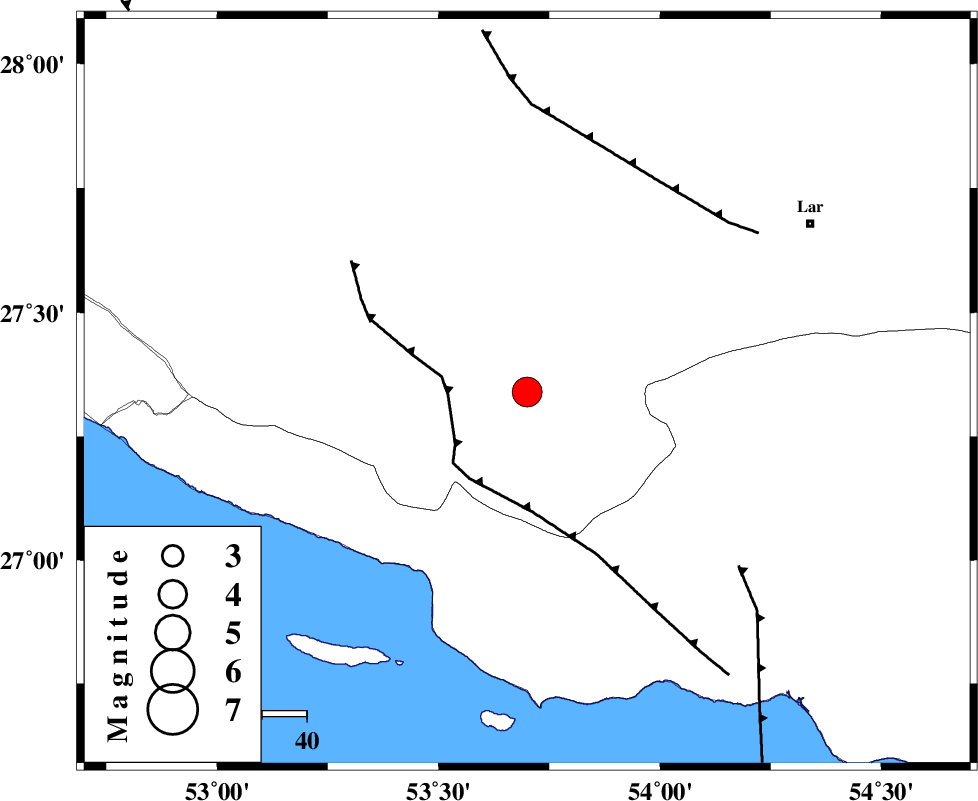
| Location | Lat:27.34 Lon: 53.7 |
| Region | Fars Province, 52 km East of Lamerd |
Nearest Cities |
|
| 16 km North of Ashkenan, Fars Province | |
| 19 km North of Ahl, Fars Province | |
| 21 km East of Beyram, Fars Province | |
| 33 km South East of Fedagh, Fars Province | |
| 37 km South West of Bagh, Fars Province | |
| Depth | 15 km |
| Agency | |
Faults within 150 km: |
|
| MFF3 (Length: 292 km) , Distance to epicenter: 31 km | |
| LAR_F (Length: 99 km) , Distance to epicenter: 39 km | |
| MFF1 (Length: 180 km) , Distance to epicenter: 45 km | |
| Number of Phases | 4 |
| RMS | 0.1 |
| Number of Stations | 5 |
| Error in Latitude | >4 km |
| Error in Longitude | 1.4 km |
| Error in Depth | 0 km |
Download waveform in seisan format
to download seisan software Click here
to access information about IIEES stations Click here
Amplitude | ||||||||
| UID | Agency | Station | Component | Amplitude | Period | Arrival Time | Proccessing Time | Signal Clip |
| 87228 | IIEES | KRBR | E | 276.3 | 0.56 | 2012-12-01 22:10:56 | 2012-12-01 11:08:00 | n |
| 87229 | IIEES | GHVR | N | 39.7 | 0.4 | 2012-12-01 22:12:00 | 2012-12-01 11:08:00 | n |
Phase | ||||||||||||
| Agency | Station | Component | Phase Type | Phase Quality | First Motion | Observed Arrival Time | Time Residual | Loc. Flag | Input Weight | Distance | Azimuth | |
| IIEES | AHRM | Z | Pn | E | 2012-12-01 22:09:33 | -0.02 | y | 290 | 306 | |||
| IIEES | KRBR | Z | Pn | E | 2012-12-01 22:09:49 | -0.09 | y | 419 | 45 | |||
| IIEES | YZKH | Z | Pn | E | 2012-12-01 22:10:08 | 0.12 | y | 567 | 9 | |||
| IIEES | CHBR | Z | Pn | E | 2012-12-01 22:10:25 | 0.05 | y | 704 | 104 | |||