
Magnitude |
:3.8 |
| Date & Time (UTC) | 2012-11-23 22:49:29.2 |
| Date & Time (Local) | 1391/9/4 02:19:29.2 |
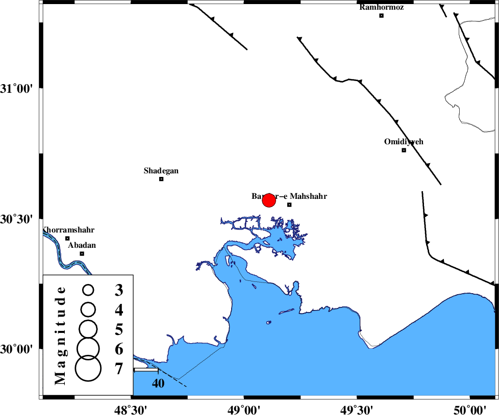
| Location | Lat:30.57 Lon: 49.11 |
| Region | Khoozestan Province, 9 km Bandar-e mahshahr |
Nearest Cities |
|
| 9 km North of Bandar-e mahshahr, Khoozestan Province | |
| 17 km South of Hashtcheh sofla, Khoozestan Province | |
| 38 km East of Buzi, Khoozestan Province | |
| 39 km South West of Abdoliyeh, Khoozestan Province | |
| 39 km South East of Gharibeh, Khoozestan Province | |
| Depth | 14 km |
| Agency | |
Faults within 150 km: |
|
| AGHAJARI_F (Length: 88 km) , Distance to epicenter: 58 km | |
| AHVAZ_F (Length: 99 km) , Distance to epicenter: 65 km | |
| RAG_E_SEFID_F (Length: 84 km) , Distance to epicenter: 65 km | |
| Number of Phases | 5 |
| RMS | 0.2 |
| Number of Stations | 4 |
| Error in Latitude | >4.9 km |
| Error in Longitude | 9.3 km |
| Error in Depth | 9.3 km |
Download waveform in seisan format
to download seisan software Click here
to access information about IIEES stations Click here
Amplitude | ||||||||
| UID | Agency | Station | Component | Amplitude | Period | Arrival Time | Proccessing Time | Signal Clip |
| 87128 | IIEES | SHGR | E | 2685.7 | 0.36 | 2012-11-23 22:50:21 | 2012-11-24 01:10:00 | n |
| 87129 | IIEES | SHGR | N | 3478.9 | 0.76 | 2012-11-23 22:50:22 | 2012-11-24 01:10:00 | n |
| 87130 | IIEES | KHMZ | E | 84.1 | 0.48 | 2012-11-23 22:51:12 | 2012-11-24 01:10:00 | n |
| 87131 | IIEES | KHMZ | N | 78.2 | 0.56 | 2012-11-23 22:51:23 | 2012-11-24 01:10:00 | n |
Phase | ||||||||||||
| Agency | Station | Component | Phase Type | Phase Quality | First Motion | Observed Arrival Time | Time Residual | Loc. Flag | Input Weight | Distance | Azimuth | |
| IIEES | SHGR | Z | Pn | E | 2012-11-23 22:49:58 | 0 | y | 173 | 350 | |||
| IIEES | SHGR | N | Sg | E | 2012-11-23 22:50:18 | -0.13 | y | 173 | 350 | |||
| IIEES | AHRM | Z | Pn | E | 2012-11-23 22:50:11 | -0.13 | y | 284 | 131 | |||
| IIEES | KHMZ | Z | Pn | E | 2012-11-23 22:50:22 | 0.36 | y | 361 | 13 | |||
| IIEES | YZKH | Z | Pn | E | 2012-11-23 22:50:46 | -0.09 | y | 559 | 67 | |||