
Magnitude |
:3.2 |
| Date & Time (UTC) | 2012-11-16 04:57:48.3 |
| Date & Time (Local) | 1391/8/26 08:27:48.3 |
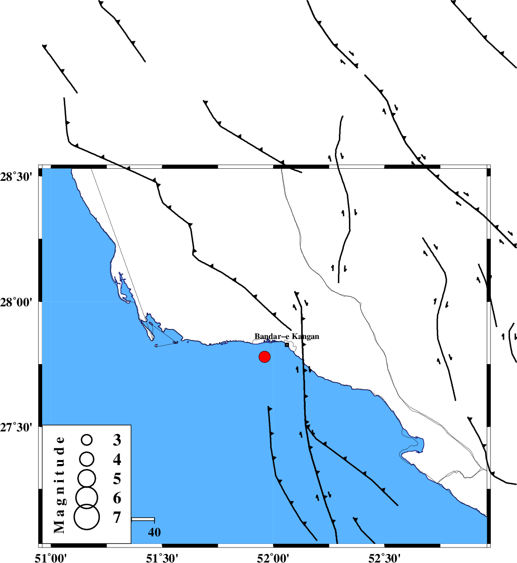
| Location | Lat:27.78 Lon: 51.96 |
| Region | Persian Gulf, 12 km West of Bandar-e kangan |
Nearest Cities |
|
| 11 km West of Bandar-e kangan, Bushehr Province | |
| 32 km South West of Riz, Bushehr Province | |
| 36 km West of Jam, Bushehr Province | |
| 39 km South East of Abdan, Bushehr Province | |
| 40 km North West of Bandar-e taheri, Bushehr Province | |
| Depth | 15 km |
| Agency | |
Faults within 150 km: |
|
| MFF3 (Length: 292 km) , Distance to epicenter: 15 km | |
| BORAZJAN_F (Length: 168 km) , Distance to epicenter: 45 km | |
| MFF5 (Length: 74 km) , Distance to epicenter: 63 km | |
| Number of Phases | 4 |
| RMS | 0.3 |
| Number of Stations | 3 |
| Error in Latitude | >16.1 km |
| Error in Longitude | 3.9 km |
| Error in Depth | 13.8 km |
Download waveform in seisan format
to download seisan software Click here
to access information about IIEES stations Click here
Amplitude | ||||||||
| UID | Agency | Station | Component | Amplitude | Period | Arrival Time | Proccessing Time | Signal Clip |
| 87037 | IIEES | GHIR | E | 729.8 | 0.76 | 2012-11-16 04:58:26 | 2012-11-16 06:11:00 | n |
| 87038 | IIEES | GHIR | N | 447.9 | 0.36 | 2012-11-16 04:58:28 | 2012-11-16 06:11:00 | n |
| 87039 | IIEES | AHRM | N | 411.7 | 0.68 | 2012-11-16 04:58:30 | 2012-11-16 06:11:00 | n |
Phase | ||||||||||||
| Agency | Station | Component | Phase Type | Phase Quality | First Motion | Observed Arrival Time | Time Residual | Loc. Flag | Input Weight | Distance | Azimuth | |
| IIEES | GHIR | Z | Pg | E | 2012-11-16 04:58:07 | -0.43 | y | 116 | 61 | |||
| IIEES | GHIR | N | Sg | E | 2012-11-16 04:58:22 | 0.13 | y | 116 | 61 | |||
| IIEES | AHRM | Z | Pg | E | 2012-11-16 04:58:11 | 0.02 | y | 137 | 332 | |||
| IIEES | KRBR | Z | Pn | E | 2012-11-16 04:59:02 | 0.44 | y | 529 | 61 | |||