
Magnitude |
:2.6 |
| Date & Time (UTC) | 2012-11-15 18:35:12.7 |
| Date & Time (Local) | 1391/8/25 22:05:12.7 |
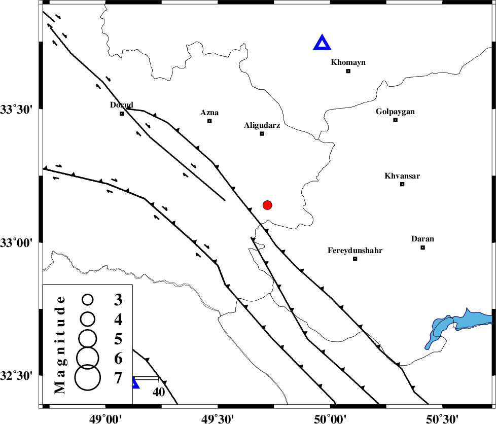
| Location | Lat:33.14 Lon: 49.72 |
| Region | Lorestan Province, 30 km South of Aligudarz |
Nearest Cities |
|
| 13 km South of Shapoorabad, Lorestan Province | |
| 13 km South of Shapoorabad, Lorestan Province | |
| 15 km North West of Farsesh, Lorestan Province | |
| 26 km West of Baltaq, Esfahan Province | |
| 30 km South of Aligudarz, Lorestan Province | |
| Depth | 16 km |
| Agency | |
Faults within 150 km: |
|
| MAIN_ZAGROS_R_F (Length: 1106 km) , Distance to epicenter: 9 km | |
| ARDAL_F (Length: 170 km) , Distance to epicenter: 15 km | |
| DORUD (Length: 100 km) , Distance to epicenter: 18 km | |
| Number of Phases | 6 |
| RMS | 0.2 |
| Number of Stations | 5 |
| Error in Latitude | >2.5 km |
| Error in Longitude | 3.4 km |
| Error in Depth | 5.7 km |
Download waveform in seisan format
to download seisan software Click here
to access information about IIEES stations Click here
Amplitude | ||||||||
| UID | Agency | Station | Component | Amplitude | Period | Arrival Time | Proccessing Time | Signal Clip |
| 87024 | IIEES | KHMZ | E | 330.4 | 0.56 | 2012-11-15 18:35:36 | 2012-11-15 06:08:00 | n |
| 87025 | IIEES | SHGR | N | 117.5 | 0.36 | 2012-11-15 18:36:00 | 2012-11-15 06:08:00 | n |
Phase | ||||||||||||
| Agency | Station | Component | Phase Type | Phase Quality | First Motion | Observed Arrival Time | Time Residual | Loc. Flag | Input Weight | Distance | Azimuth | |
| IIEES | KHMZ | Z | Pg | E | 2012-11-15 18:35:25 | 0.18 | y | 70.4 | 18 | |||
| IIEES | SHGR | Z | Pg | E | 2012-11-15 18:35:36 | -0.04 | y | 143 | 217 | |||
| IIEES | ASAO | Z | Pg | E | 2012-11-15 18:35:39 | 0.07 | y | 159 | 10 | |||
| IIEES | GHVR | Z | Pn | E | 2012-11-15 18:35:45 | -0.32 | y | 205 | 43 | |||
| IIEES | SNGE | Z | Pn | E | 2012-11-15 18:35:59 | 0.36 | y | 308 | 315 | |||
| IIEES | SNGE | N | Sg | E | 2012-11-15 18:36:39 | -0.24 | y | 308 | 315 | |||