
Magnitude |
:2.9 |
| Date & Time (UTC) | 2012-11-12 11:05:47.5 |
| Date & Time (Local) | 1391/8/22 14:35:47.5 |
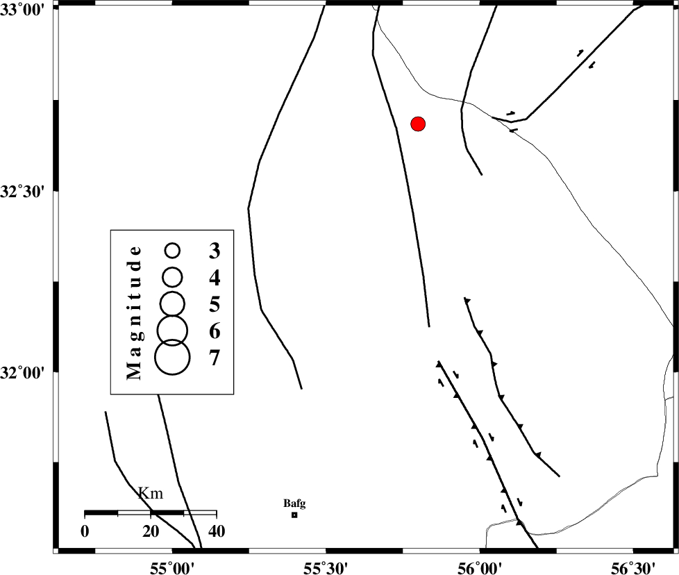
| Location | Lat:32.26 Lon: 55.63 |
| Region | Yazd Province, 76 km North-East of Bafq |
Nearest Cities |
|
| 57 km North West of Behabad, Yazd Province | |
| 60 km North West of Kushk, Yazd Province | |
| 72 km North West of Benestan, Yazd Province | |
| 73 km North East of Mobarake, Yazd Province | |
| 76 km North East of Bafq, Yazd Province | |
| Depth | 14 km |
| Agency | |
Faults within 150 km: |
|
| SARBALA_F (Length: 92 km) , Distance to epicenter: 18 km | |
| JAFARABAD_F (Length: 60 km) , Distance to epicenter: 31 km | |
| POSHT_E_BADAM_F (Length: 128 km) , Distance to epicenter: 33 km | |
| Number of Phases | 6 |
| RMS | 0.3 |
| Number of Stations | 4 |
| Error in Latitude | >3.5 km |
| Error in Longitude | 3.4 km |
| Error in Depth | 7.7 km |
Download waveform in seisan format
to download seisan software Click here
to access information about IIEES stations Click here
Amplitude | ||||||||
| UID | Agency | Station | Component | Amplitude | Period | Arrival Time | Proccessing Time | Signal Clip |
| 86985 | IIEES | KRBR | N | 52.8 | 0.62 | 2012-11-12 11:07:07 | 2012-11-12 10:21:00 | n |
Phase | ||||||||||||
| Agency | Station | Component | Phase Type | Phase Quality | First Motion | Observed Arrival Time | Time Residual | Loc. Flag | Input Weight | Distance | Azimuth | |
| IIEES | YZKH | Z | Pg | E | 2012-11-12 11:06:04 | -0.27 | y | 98.7 | 279 | |||
| IIEES | TABS | Z | Pn | E | 2012-11-12 11:06:21 | 0.03 | y | 208 | 42 | |||
| IIEES | KRBR | Z | Pn | E | 2012-11-12 11:06:30 | 0.65 | y | 275 | 157 | |||
| IIEES | KRBR | N | Sg | E | 2012-11-12 11:07:04 | -0.26 | y | 275 | 157 | |||
| IIEES | BSRN | Z | Pn | E | 2012-11-12 11:06:36 | 0.1 | y | 332 | 95 | |||
| IIEES | BSRN | E | Sg | E | 2012-11-12 11:07:20 | -0.26 | y | 332 | 95 | |||